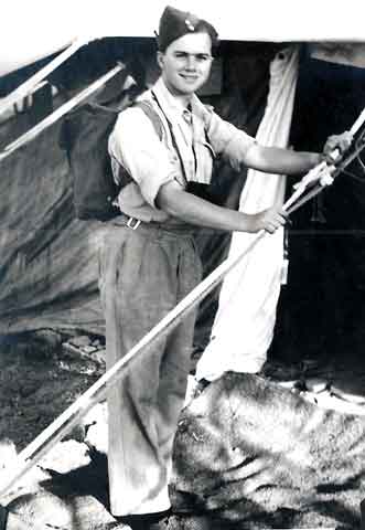
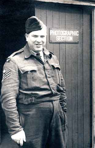
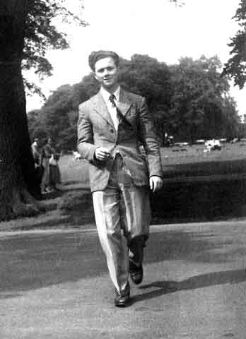
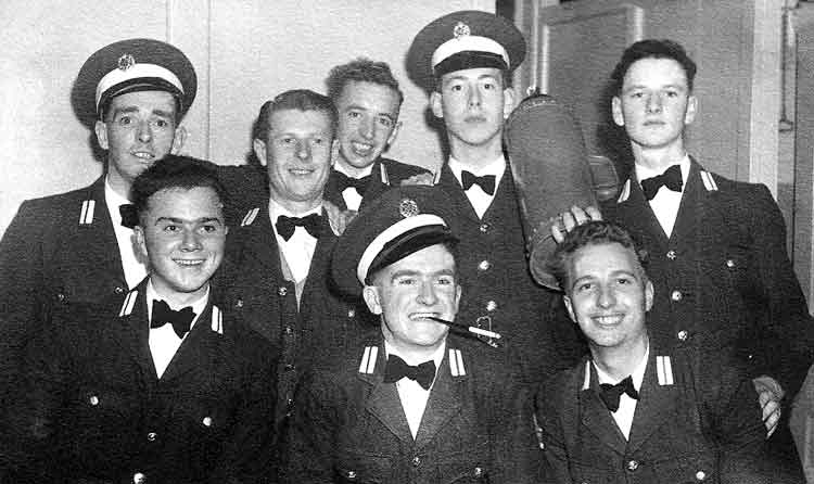
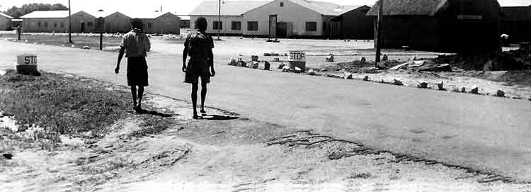
Bebe Sharman was a charismatic individual with a tremendous sense of humour. He was responsible for all the amusing history and background to the Jever Steam Laundry. This page is dedicated to his life in the RAF and his sense of humour. He was a professional photographer having joined the RAF originally as an airman in the photographic branch. We are grateful to
Mamie Sharman, his widow, who has kindly given us his five photo albums to load on to the web site in his memory.
The Five Albums, (a total of 761 photos), are as follows (Click on the green title to jump to that album):
Album 1 - January 1948 to November 1948 RAF Luqa, Malta - 198 photos.
Album 2 - November 1948 to February 1951 RAF Luqa, Malta, Castel Benito, Libya, RAF Jurby, Isle of Man, flying training at RAF Heany in Northern Rhodesia - 214 photos.
Album 3 - February to November 1951 Flying Training in Rhodesia - 139 photos.
Album 4 - December 1952 to March 1955 Venoms at Fassberg and Hunters at Jever- 120 photos.
Album 5 - December 1955 to July 1966 Hunters at Jever and civilian life - 90 photos.
Album 2 November 1948 at RAF Luqa in Malta to February 1951 at RAF Heany, Northern Rhodesia - 214 photos.
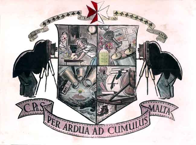
Bebe's idea for the "Coat of Arms" for the Photographic Section at RAF Luqa in Malta.
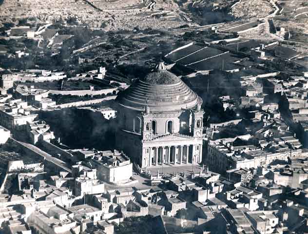
Mosta Dome, Malta from the air.
The Church of the Assumption of Our Lady, commonly known as the Rotunda of Mosta or Rotunda of St Marija Assunta (sometimes shortened to as The Mosta Dome) is a Roman Catholic church in Mosta, Malta. It is the fourth largest unsupported dome in the world and the third largest in Europe. Built in the 19th century on the site of a previous church, it was designed by the Maltese architect Giorgio Grognet de Vassé. Its dome is among the largest in the world, with an internal diameter of 37.2 metres (122 ft). The rotunda walls are nearly 9.1 metres (30 ft) thick.[1] The rotunda dome is the third-largest church dome in Europe and the ninth largest in the world. Grongnet's plans were based on the Pantheon in Rome. Construction began in May 1833 and was completed in the 1860s. The original church was left in place while the Rotunda was built around it, allowing the local people to have a place of worship while the new church was being built. The church was officially consecrated the 15 October 1871. On April 9, 1942, during an afternoon air-raid, a 200 kg Luftwaffe bomb pierced the dome (two others bounced off) and fell among a congregation of more than 300 people awaiting early evening mass. It did not explode. Its replica is now on display inside the rotunda under the words Il-Miraklu tal-Bomba, 9 ta' April 1942 (Maltese: The Bomb Miracle, April 9, 1942). One version of this event states that, upon opening the bomb, it was found to be filled with sand instead of explosive and contained a note saying "greetings from "Plzen" from the workers at Skoda Works in the German-occupied Czechoslovakia (then Protectorate of Bohemia and Moravia) who had allegedly sabotaged its production. (Thanks to Wikipedia).
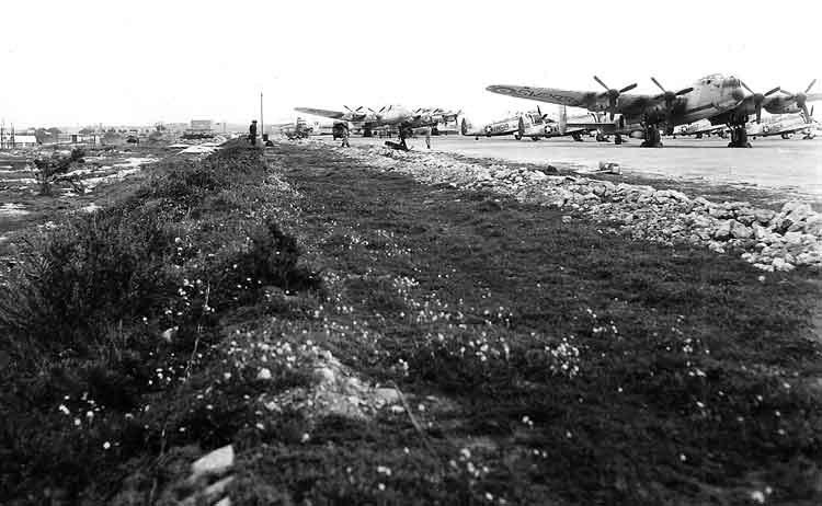
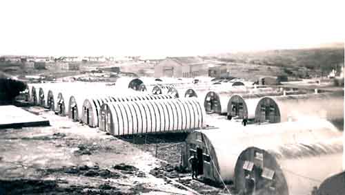
Lancasters at RAF Luqa - 1948. Built during World War II, this four-engined bomber had survived the war and was later modified for maritime search and rescue. It had been delivered in Apr51 to No. 37 Long-Range Maritime Reconnaissance Squadron, Royal Air Force (RAF). The squadron had been flying Lancasters since 1946 at Fayid, in Egypt, and in May 1948, with the withdrawal of the British from Palestine, moved to RAF Luqa. By 1952, the Lancaster was showing its age. In fact, at that time No. 37 Squadron was already planning its crew's conversion onto the Shackleton with which the unit was to be equipped in the summer of the following year.
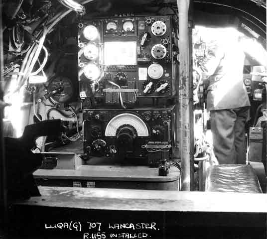
Radio R1155tted in the Lancaster. (Click to see video of it operating.)
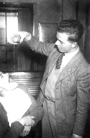
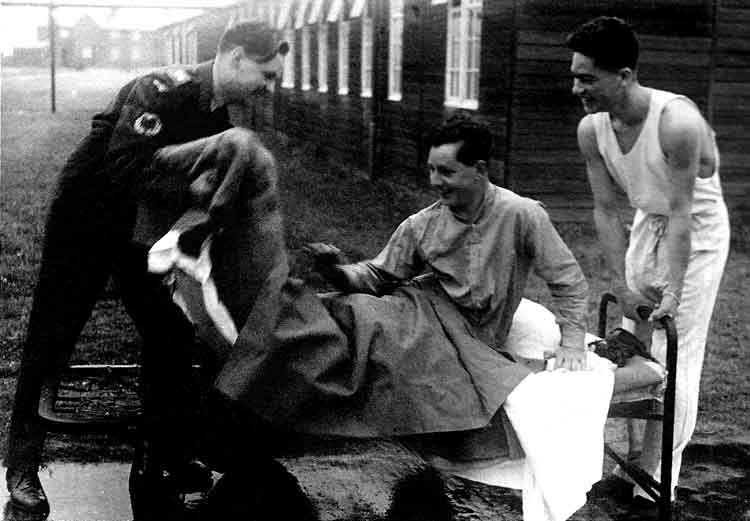
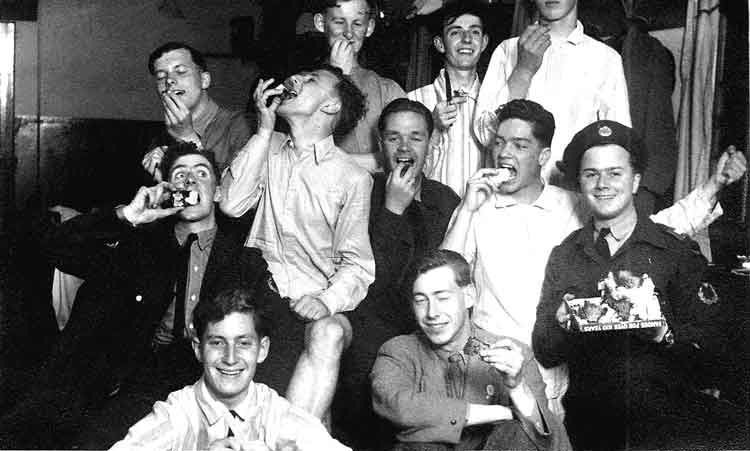
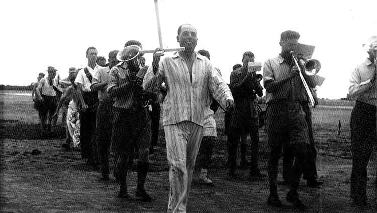
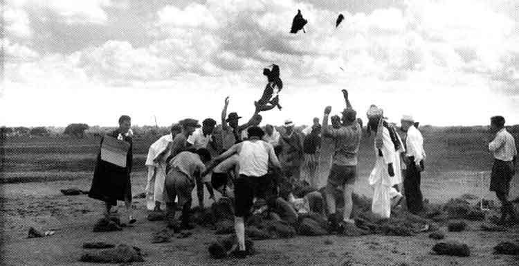
Some Christmas Day 1948 hi-jinks involving "Carting the coffin".
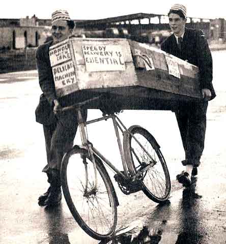
Cave and Jock seeing the coffin on its way - 25Dec48.
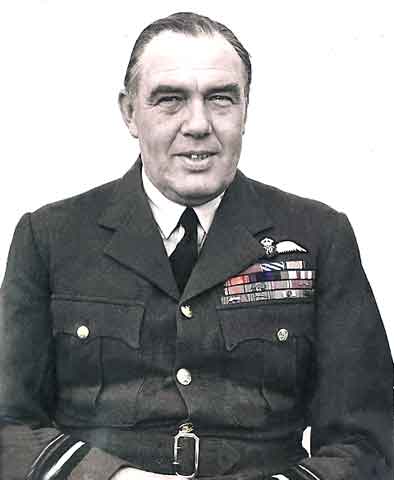
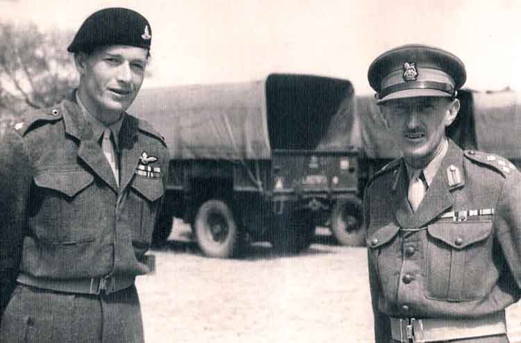
Air Vice Marshal Sir Charles Ronald Steele KCB, DFC - Air Officer Commanding Malta 6Jun47 to 31Dec49.
or as BeBe called him "Good Old Charlie".
Attended
RMC Sandhurst. 21Jan16 Officer, Green Howards; 22May16 Pilot 15Sqn
RFC; Apr17 Instructor, Montrose and Turnberry; 1917 School of Special Flying;15Nov17 Instructor, School of Aerial Fighting, Ayr; Jan18 Attached, 20Sqn
RFC; Feb18 Flt Cdr 48Sqn; 24Aug18 Recuperating; 1918; Instructor, 59 Wing Cranwell; Netheravon; 28Oct19 Permanent Commission as Fg Off 1Aug19; 3Dec19 Pilot 28Sqn; 26Mar23; Supernumerary, RAF Depot 3Sep23; Staff Officer HQ 10 Grp; 27May24 Air Staff, HQ 1 Grp; 4Jun26 RAF Staff College; 30Jul27 Air Staff 1(Air Defence)Grp; 21Jan30 Flt Cdr 47Sqn; 26Jul31 Air Staff, HQ Transjordan and Palestine; 30Oct33 Supernumerary, RAF Depot; 17-20Jan34 Placed on half pay list, scale A; 21Jan34 Army Staff College Camberley; 4Jan36 Off Cmd 18Sqn; 6May37 Air Staff, HQ 3Grp; 1940 Staff, HQ
BAFF; 1941
SASO?, Rhodesian Air Trg Grp; 1942
SASO HQ 9Grp; 9Nov42
AOC(Temp) 9 Grp; 5May43
AOC 10 Grp; 10Jul44
AOC 85 Grp; 15Jul45
SASO HQ British Air Forces of Occupation; 6Jun47
AOC AHQ Malta; 1Jan50
AOC in C Coastal Command. Having attended Oundle School and completed his training at the Royal Military Academy at Sandhurst he was commissioned into the Green Howards and was almost immediately seconded to the
RFC, gaining his
RAeC Certificate, No 2662 on 31 March 1916. His first operational posting was to France flying BE2's with 15 Sqn where he remained for about a year before retuning to Britain. After instructional duties he returned to operations with 20 Sqn but four weeks later was posted to 48 as a flight commander. On 24Aug18 he was seriously injured in a night bombing attack on the airfield at Bertangles and spent the remainder of that war in hospital. By the time he was invalided home he had achieved a total of seven victories and been awarded the
DFC. On 1Jul47 his area of responsibility was increased when control of RAF units operating from North African bases was transferred to
AHQ Malta from 205 Grp in Egypt. He was invalided out of the RAF in 1952. He became Deputy Lieutenant for Cambridge in 1962.
View from the Squash Courts.
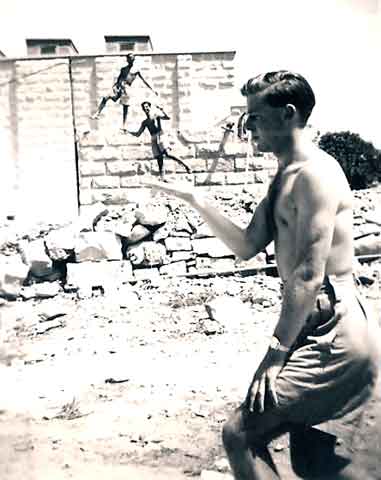
Les Marshall and his "little friends". Even then BeBe could not resist a twist to his shots.
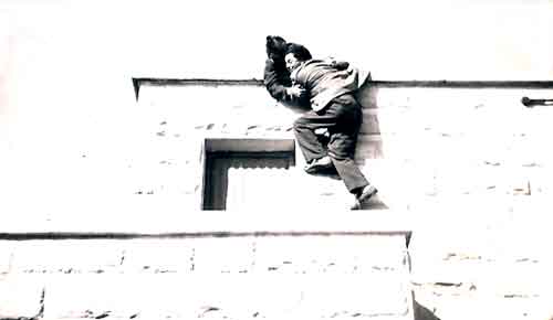
BeBe being helped down from somewhere.
BeBe taking photos for RAF Form 1250s at Castel Benito, Tripoli, Libya.
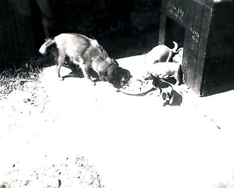
Ju-Ju and family (very ferocious).
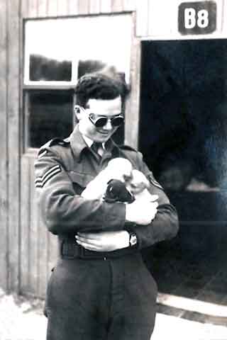
Armful of mischief.
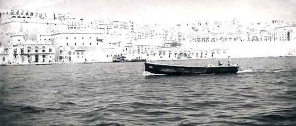
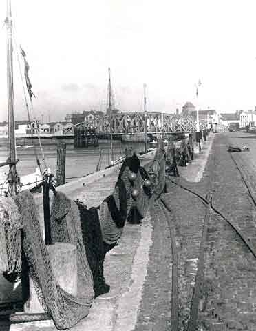
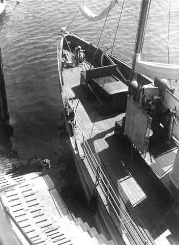
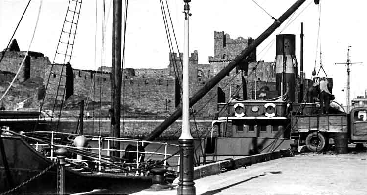
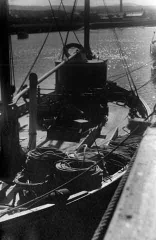
Dockside, Valletta, Malta.
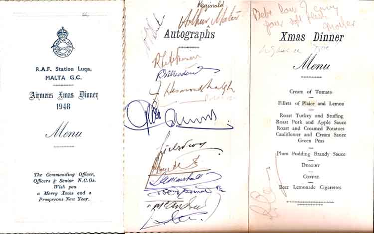
Airmen's Mess Christmas Lunch Menu - 25Dec48.
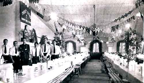
RAF Luqa, Malta Airmen's Mess laid out for Christmas Lunch - 25Dec48.
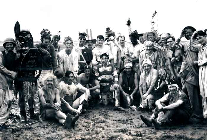
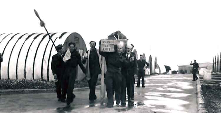
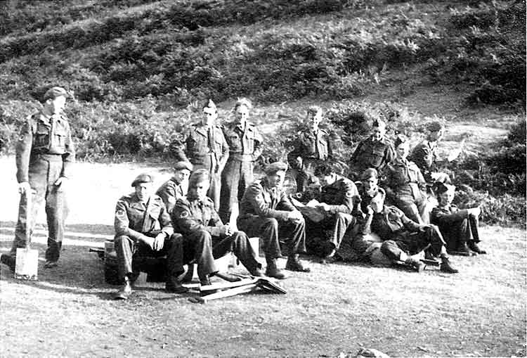
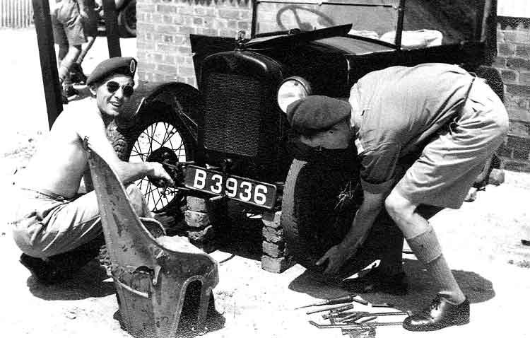
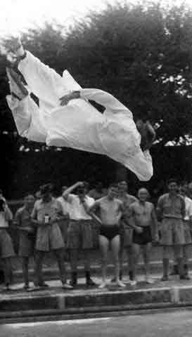
Comic Football Match Christmas Day RAF Luqa, Malta - 25Dec48.
Comic Football Match Christmas Day RAF Luqa, Malta, Wg Cdr Dios handcuffed to the goal posts - 25Dec48.
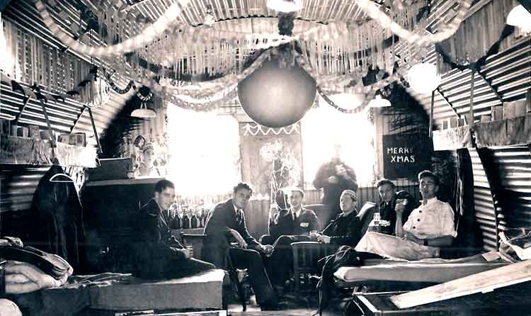
B7 Billet - bags to drink! - 25Dec48.
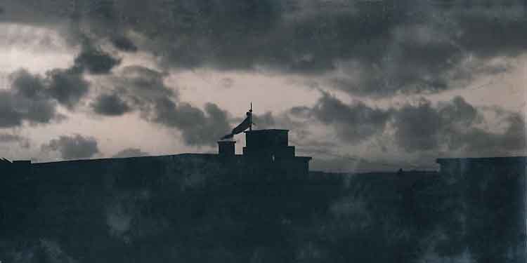
With the flag and balloon still flying over the ablutions the sun sets on Christmas Day 1948.
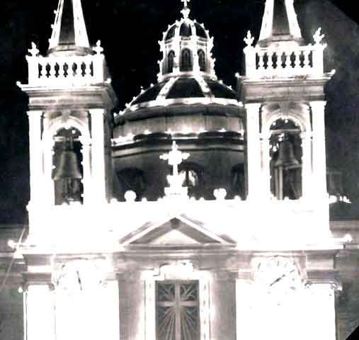
Local Church decorated for Christmas - Dec8.
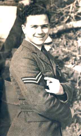
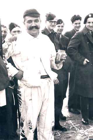
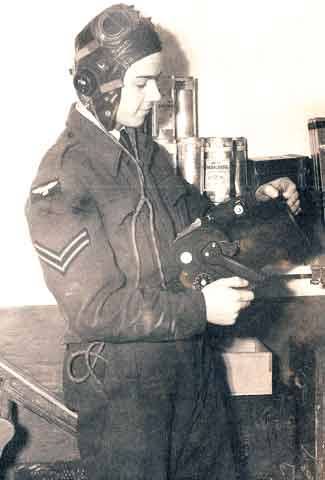
Look! Tapes through! BeBe makes Corporal.
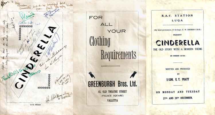
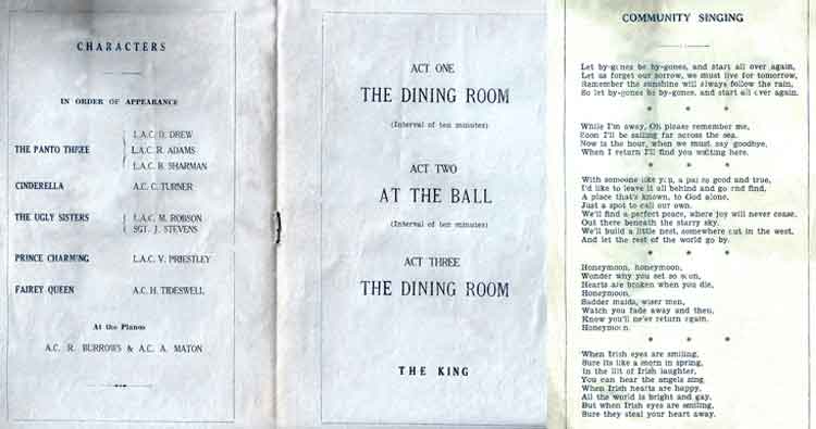
Programme for RAF Station Luqa Pantomime Cinderella - Christmas 1948. Note a certain LAC B Sharman as one of the Panto Three.
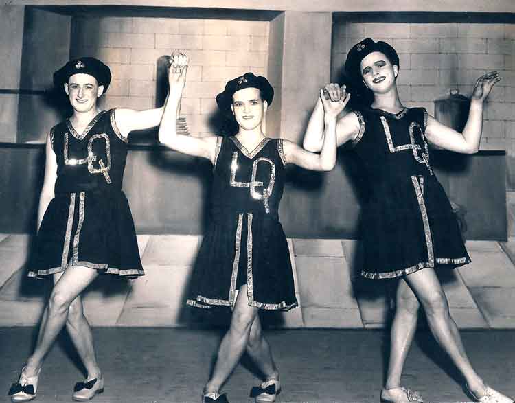
The Panto Three! BeBe in the centre.
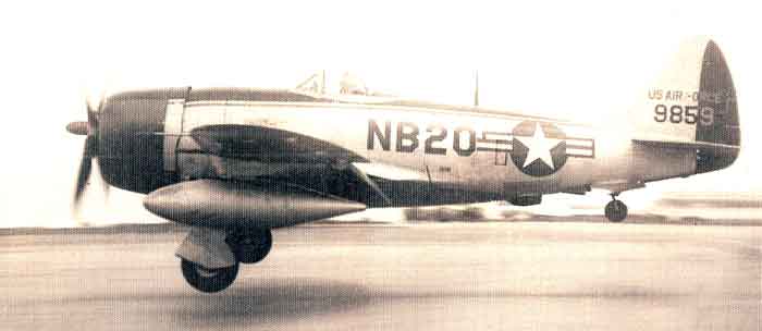
USAF Republic P-47 Thunderbolt landing at RAF Luqa, Malta - about 1949.
Republic P-47 Thunderbolt
The Republic Thunderbolt, one of the truly great fighters of World War II, was designed around the most powerful engine then available, the new 1,492KW (2,000 hp) Pratt & Witney Double Wasp radial. The design was submitted to the US Army Air Corps in June 1940 as the XP-47B and was immediately accepted, orders being placed in September for 171 production P-47Bs and 602 P-47Cs. The two were basically similar, except that the P-47C had a slightly longer fuselage to improve stability. The XP-47B flew for the first time on 6 May 1941. Numerous teething troubles manifested themselves, examples being the 'snatching and freezing' of the ailerons at altitudes above 9,150 m (30,000 ft), excessive control loads and the jamming of the cockpit canopy at high altitudes, but these were progressively eradicated and in March 1942 the first production P-47B came off the assembly line.
In June 1942 the 56th Fighter group began to rearm with the P-47, and in December 1942-January 1043 it deployed to England, flying its first combat mission - a fighter sweep over St Omer - on 13 April 1943. During the next two years it was to destroy more enemy aircraft than any other fighter group of the Eighth USAAF. From that first operational sortie over Europe until the end of the fighting in the Pacific in August 1945, Thunderbolts flew 546,000 combat sorties, dropped 134,129 tonnes (132,000 tons) of bombs, launched 60,000 rockets and expended more than 135 million rounds of ammunition. In the European Theatre alone, from D-Day (6 June 1944) to VE Day (8 May 1945), the Thunderbolt was credited with destroying 9,000 locomotives, 86,000 railway wagons and 6,000 armoured vehicles. In all theaters of war, its pilots claimed the destruction of 3,752 enemy aircraft in the air and a further 3,315 on the ground.
By the time the 56th Fighter Wing flew its first operational sortie in the spring of 1943, huge orders had been placed for the P-47D, which was at first externally almost identical to the P-47C. As time went by, however, so many changes were introduced n the P-47D that it differed as much from the original P-47D as did that fighter from the XP-47B prototype. In all, 12,602 P-47Ds were built by Republic in four batches, a further 354 being built by Curtiss-Wright as P-47Gs. The RAF acquired 354 early model P-47Ds as the Thunderbolt I, while a further 590 later model P-47Ds were supplied as the Thunderbolt II. All the RAF's Thunderbolts were assigned to squadrons in South-East Asia Command (India and Burma), where they replaced the Hawker Hurricane in the ground-attack role.
The next production version was the P-47M. 136 being completed with the 2,089 KW (2,800 hp) R-2800-57 engine. It was built specifically to help combat the V-1 flying bomb attacks on Britain. The last variant was the P-47N, a very-long-range escort and fighter bomber, of which Republic built 1,816. Overall P-47 production, which ended in December 1945, was 15,660 aircraft. About two-thirds of these, almost all P-47Ds, survived the war and found their way into the air forces of Brazil, Chile, Colombia, Dominica, Ecuador, Mexico, Peru, Turkey and Yugoslavia. France also used the P-47D in an operation against dissidents in Algeria during the 1950s, the Armée de l'Air having found jet aircraft unsuitable for close support in that particular environment. During World War II the Soviet Union received 195 P-47s out of the 203 allocated, some having been lost en route. Specifications apply to the P-47D.
Crew: 1; Powerplant: one 1,716 KW (2,300 hp) Pratt & Whitney R-2800-59 radial engine; Performance: max speed 689 Km/h (428 mph); range 2,028 Km (1,260 miles) service ceiling 12,800 m (42,000 ft) Dimensions: wingspan 12.43 m(40 ft 9 in); length 11.01 m (36 ft 1 in); height 4.32 m (14 ft 2 in). Weight: 8,800Kg (19,400 lb) loaded. Armament: six or eight 12.7 mm (0.50 in) machine guns; two 454 Kg (1,000 lb) bombs or 10 RPMs. (Thanks to The Encyclopedia of Aircraft edited by Robert Jackson).
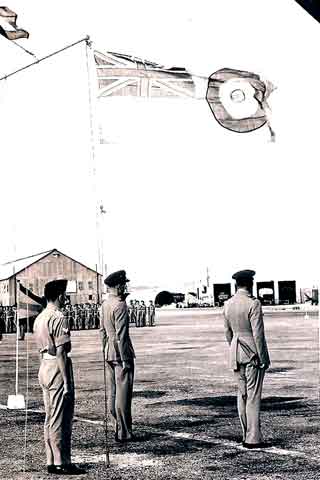
AOC's Parade RAF Luqa, Malta - flag keeps flying - about 1949.
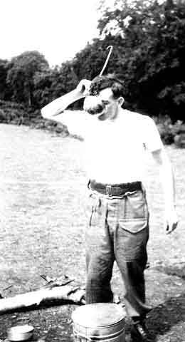
Big Line Shoot! - BeBe does a pre-flight check.
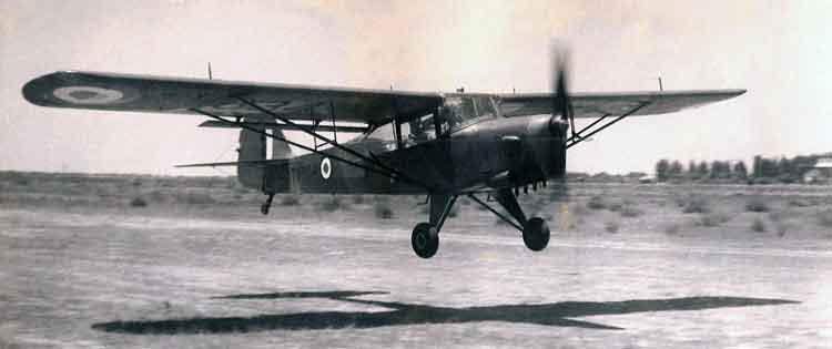
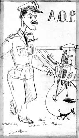
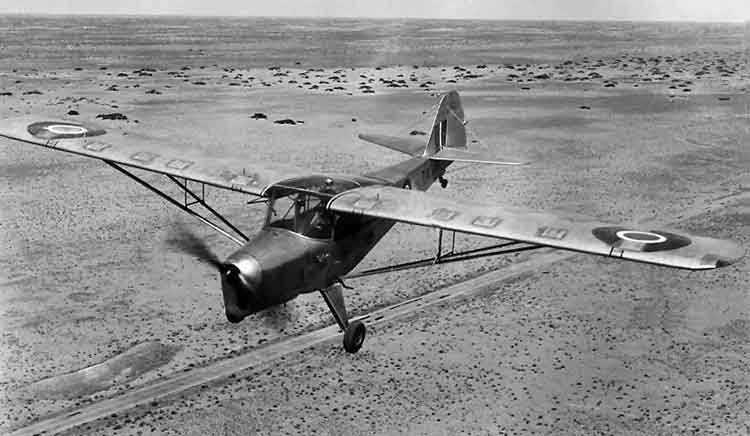
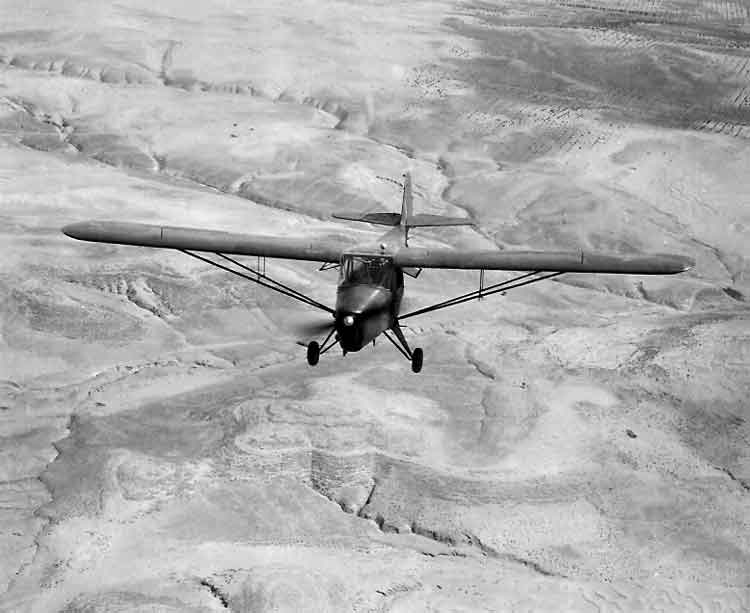
Swinging the Auster AOP Mk.6 prop.
Auster AOP3-AOP9
The Auster AOP.3 was the first in a series of air observation posts designed by Auster Ltd. It saw wartime service from 1943 and developed into the AOP.9, of which 296 examples were built for the RAF and the Belgium Air Force, together with 36 of a slightly modified version for the RCAF. The AOP.7 was a two-seat dual-control trainer version, while the AOP.8 was intended to combine the features of both Mk.6 and Mk.7 , but was not furthered. Last in the series was the AOP.9, a tough and versatile monoplane which first flew on 19 March 1954 and incorporated many lessons learned during the Korean War, in which the AOP.6 was used extensively by the British Army for artillery spotting and other duties. The first AOP.9s were issued to RAF units at the beginning of 1954, and a second order followed in 1959. Austers of various marks were also used by Iraq, Jordan, Rhodesia and South Africa. Specifications apply to the Auster AOP.9.
Crew: 2/3; Powerplant: one 135 KW (180 hp) Blackburn Cirrus Bombardier 203 4-cylinder in-line engine; Performance: max speed 204 Km/h (127 mph); range 395 Km (246 miles) service ceiling 5,640 m (18,504 ft) Dimensions: wingspan 11.10 m(36 ft 5 in); length 7.21 m (23 ft 8 in); height 2.56 m (8 ft 5 in). Weight: 966 Kg (2,130 lb) loaded. Armament: None. (Thanks to The Encyclopedia of Aircraft edited by Robert Jackson).
Ah We will make her go!
Little WOGS" - Eating BeBe's peanuts.
651 AOP Sqn was based at Castel Benito, Tripoli, Northern Libya. This picture shows two of their Auster AOP Mk.6s operating from Garian - Apr49. Originally Castel Benito was a Regia Aeronautica (Italian Air Force) airfield where later the first units of Italian parachutists were trained and formed shortly before the Second World War. The first Italian Military Parachute School was located at Castel Benito. The first troops trained were two Libyan battalions, the Libyan Parachute Battalion and the 1st National Libyan Parachute Battalion, of the Royal Colonial Corps. After it was captured by the British, the airfield was renamed RAF Station Castel Benito and was used by a number of operational squadrons involved in the desert war, sometimes for only a few days or weeks at a time. In 1952, the station was renamed RAF Idris in honour of the Libyan King Idris at the request of the Libyan government. The station was used as a staging post for flights to and from the United Kingdom to the Middle East and Far East. It was also used in the 1950s as a base for aircraft using the Libyan desert bombing ranges (Tahuna) for practice. The station was closed in the late 1960s when the Libya became a republic. Following the withdrawal of the RAF from Libya, the airfield became Tripoli Idris Airport. It is now known as Tripoli International Airport.
Auster AOP Mk.6 634 landing at Castel Benito, Libya, (today's Tripoli International Airport), without flaps - Apr49(? see below).
Ian O'Neil has kindly contributed the following information about the AOP operations in Libya: 2-22Apr49 651 Sqn SHQ, 1908 and 1910 Flights at Castel Benito, Tripolitania. On the 2nd a month of intensive training began when the Squadron moved to Garian artillery ranges (map ref 530 690) and co-operated with RA 1 Inf Div plus attached artillery units during the annual practice camp which finished on 22nd. During the camp shoots, low flying and operation out of strips were practiced. 1910 Flight, as a Type B Flight, also flew PR sorties" I presume that it was to assist with photographs from the latter that BeBe was posted to 651 Sqn. Ian is concerned that this shot of an apparently camouflaged Auster was not taken until after May51 when camouflage was first added to the Mk.6s. BeBe appears to have returned to UK in Jan50 to begin his flying training so I am not sure when this picture was taken. Ian tells me "TW634 is interesting for several reasons as follows:- It has the original internally sprung tailwheel but I am not at all sure when the external version was introduced but very early 1950s is certain. All the silver examples carry the unit code but as far as I can see in your scan there is no code on TW634 which is the only Mk.6 I have seen shown in Libya in camouflage. Your comment re possible camouflage trials is possibly very pertinent as the aircraft was with the Light Communications Trials Flight for two months but I have no idea what that unit actually trialled. Another interesting point I have realised about TW634 is that it has Type D roundels and fin flashes whereas the silver aircraft have Type C. Unfortunately the changeover occurred during 1948 so I am no nearer 'dating' the camouflaged photograph as I do not know the exact month during 1948 when the amended styles were introduced. The aircraft's history with 651 Sqn is as follows:- TW634 allotted 47 MU 2Sep46 for dismantling/boxing and shipped aboard City of Dunkirk which sailed for Port Said where it arrived 14Dec46. To 651 Sqn/1908 Flt, Qastina, Palestine 29Jan48. To Light Comms Trials Flight, Ismailia 26Feb48 until returned to 651 Sqn 12Aug48 and remained with that unit until it disbanded 31Oct55 and then to 1910 Flt, Cyprus on 1Nov55.
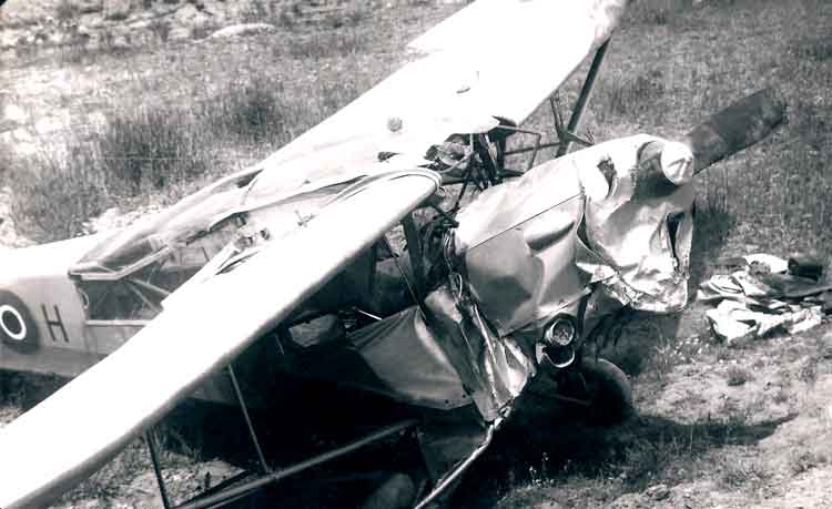
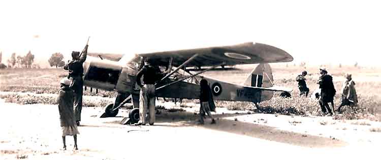
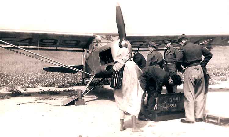
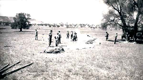
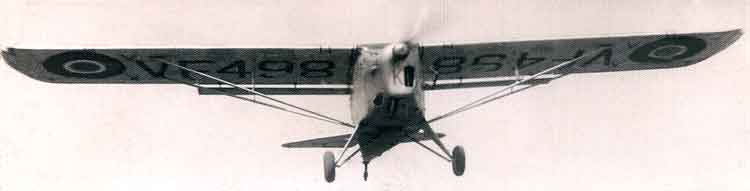
Oh, Wizard prang Sir!! That will larn 'im - Captain Waldram's prang in Auster AOP Mk.6 499 - 5Apr49.
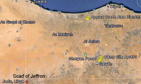
Ian O'Neil further adds the following information about this accident: "On 5th while flying VF499 Capt Waldram RA failed to become airborne when taking off from Garian air strip due to a very sandy surface and no wind. He crashed into a deep wadi approximately 100 yards from the end of the strip. The aircraft is damaged beyond repair but the pilot only suffered minor cuts and bruises. VF499 Cat E on 5Apr49 at 1045 hrs. During an attempted take-off by Capt O.J.Waldram RA in the Garian area (map ref sheet 1574 Tripoli, 344 635), the aircraft failed to become airborne due to soft ground and crashed into the shoulder of a wadi (Form 1180)". See the aerial photo of the suspect air strip below and the Wadi off the North-West end.
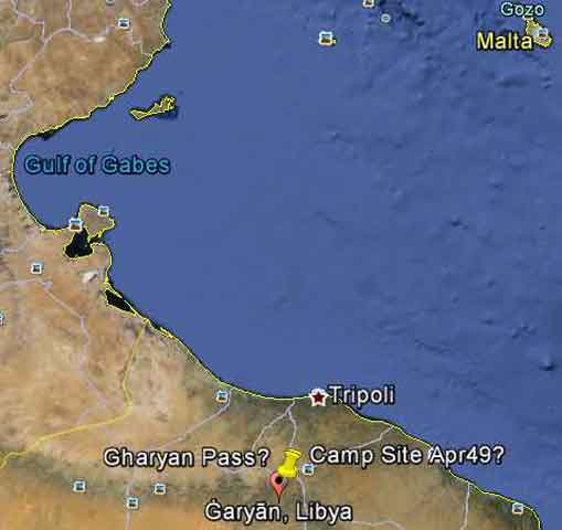
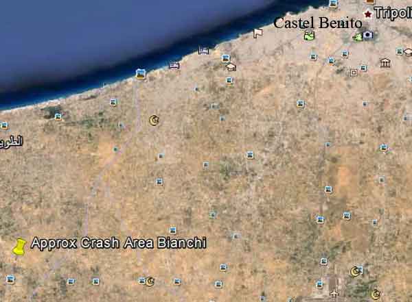
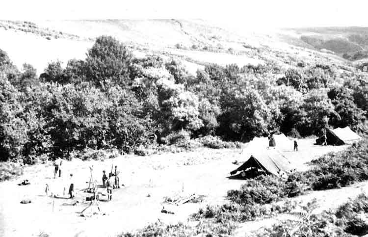
It would appear from his album that BeBe was sent with 651 AOP Squadron on a camp near Ghana in Libya. This is about 260 miles south of Malta. It lies about 50 miles inland behind Tripoli. Presumably he would have been detached to process the aerial photographs taken by the AOP Squadron.
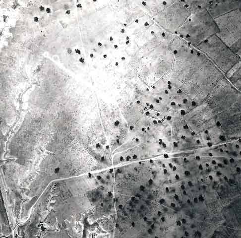
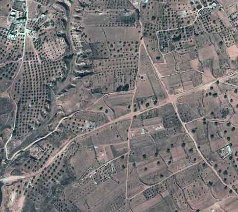
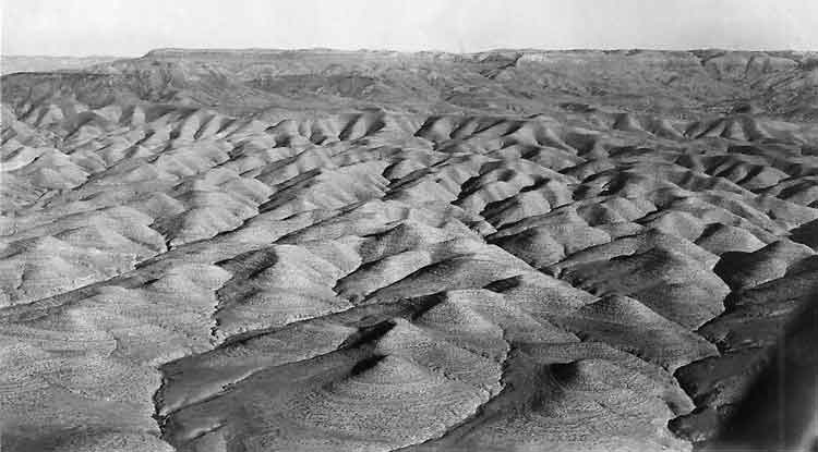
Top picture is an Aerial view of the Campsite at Garian Pass, (Taken from 3,000 ft with a 5inch lens). - Apr49. The only Gharyan I can find is in Libya and a later photo below from BeBe's album is of the "Lady of Garian" by Clifford Saber on the walls of the old Italian Mess. This is described in Wikipedia as follows: "Just west of Gharyan, Libya there is a primitive road to the right, which provides a bumpy trip to a derelict former Italian barracks, a relic of World War II. There is a crumbling building at the camp. Painted on the bricks of one of the walls inside the building is an enormous (c.4m by 10m) representation of a naked woman, lying on her side, American pin-up style. The upper torso of the woman is shaped as an inaccurate representation of the North Africa coast, and the salient points of her anatomy are marked with names of North African towns. The "Lady of Garian" was drawn by Clifford Saber, a volunteer American ambulance driver with the British 8th Army. Saber created the mural to help boost the morale of his fellow servicemen, finishing on 2Mar43, while his unit was housed for a few days at the barracks in Gharyan". To the East of Gharyan the road passes through an open area which could be the "Garian Pass" where BeBe camped. I attach above a shot from Google Earth today, (taken Dec2012, 63 years later), of the area that possibly might match the aerial photo taken by BeBe?. In the top photo it looks like there is an improvised airstrip for the Austers to the North-West of the campsite, with turning circles at the end, of which there is no trace today. If this is the Auster air strip, then the Wadi off the North-West end of the strip, which shows up better in the Goggle picture, would probably be where Capt Waldram crashed.
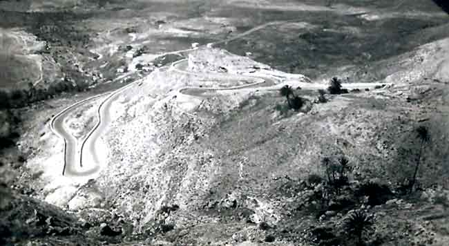
Top picture is from BeBe's album and is captioned as " Garian Pass. The bottom shot is from Google Earth of a similar road bend in the main road to the East of Gharyan, just before it drops down into the town, about a mile and a half West of where the camp site may have been?.
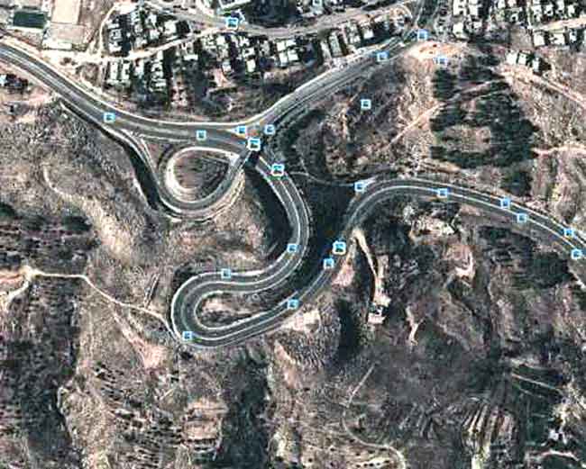
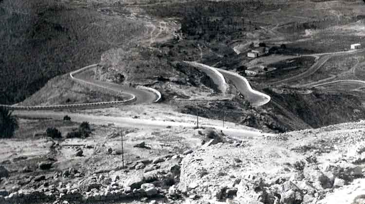
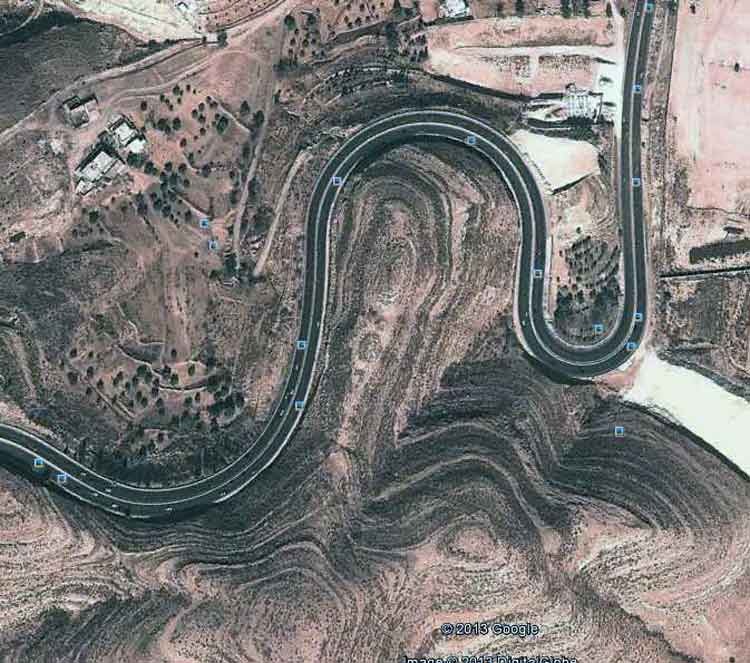
Top picture is another shot from BeBe's album and is again captioned as "Garian Pass. The bottom shot is from Google Earth of a similar road bend on the main road descending to the outskirts of Gharyan. It would appear that there has been a new viaduct added at the bottom of the hill on the left.
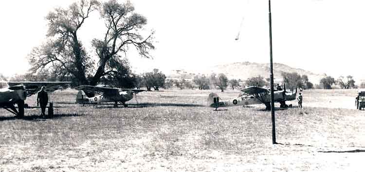
Auster AOP Mk.6s of 651 AOP Squadron deployed on the air strip at Garian, Libya - Apr49.
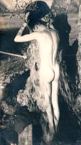
BeBe caught taking a shower! (Improvised), at the camp site at Garian, Libya.
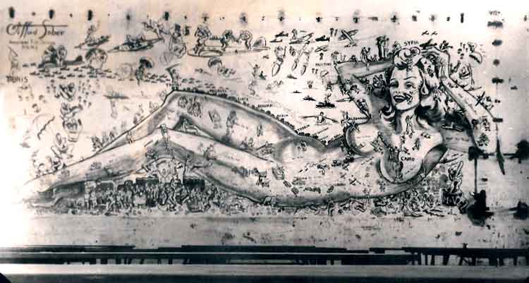
The Lady of Garian" - Apr49. BeBe reports that this was a large drawing on the wall of the Mess - a great distraction whilst eating one's dinner! This mural is described in Wikipedia as follows: "Just west of Gharyan, Libya there is a primitive road to the right, which provides a bumpy trip to a derelict former Italian barracks, a relic of World War II. There is a crumbling building at the camp. Painted on the bricks of one of the walls inside the building is an enormous (c.4m by 10m) representation of a naked woman, lying on her side, American pin-up style. The upper torso of the woman is shaped as an inaccurate representation of the North Africa coast, and the salient points of her anatomy are marked with names of North African towns. The "Lady of Garian" was drawn by Clifford Saber, a volunteer American ambulance driver with the British 8th Army. Saber created the mural to help boost the morale of his fellow servicemen, finishing on 2Mar43, while his unit was housed for a few days at the barracks in Gharyan". Presumably, whilst BeBe was under canvas at the nearby Garian Pass, this was a British Mess still in use when he visited it and took this photo.
Pitching Camp at Garian - Apr49.
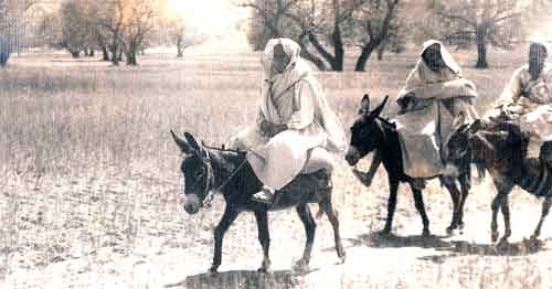
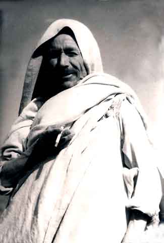
Arab Transport - Apr49.
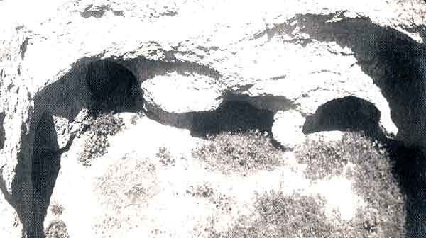
View of Dwelling Caves, Tripolitania, Libya - Apr49.
Libya renovates ancient cave houses - Article from Al Arabiya News dated Thursday, 31 May 2012.
Click on the following green link to play a video clip about the caves today (31May12):
http://vod.alarabiya.net/2012/05/6fcb4c899a5b871274898cbdb074a4ab.flv
Deep inside Libya's Naufosa Mountains, in the Berber village of Gharyan, one can find a thousand unique troglodyte cave houses.
These unusual dwellings are located 120 kilometers from the country's capital, Tripoli. The homes are dug six to seven meters vertically into the mountain, creating rooms circled around a central courtyard housing several families. Residents hope their unique village can attract tourists after the elections. "This house was dug out in the year 1666 which makes it a 346-year-old house," says the current owner of the house Al-Arabi Bilhaj. "Omar Bilhaj, his sons, his grandchildren and great grandchildren lived in this house. Since it was dug out, it hasn't been abandoned a single day. The house has eight rooms and three kitchens. A family was living in each room and each room is divided into three sections: one for the parents, one for children and one serves as a living room," he said. In the Western mountains cave houses are currently unoccupied, but some have been restored and are open to tourists. "This house initially was not made for tourism. We have to restore and preserve the history of our ancestors and our hometown. Perhaps tourism in Libya will pick up and we'll be able to use this house as a tourist site," Bilhaj said. Following the revolution that overthrew Libya's leader Muammar Qaddafi, the country suffered a drop in tourism and hoped that the new government would bring security and a return of visitors. A number of Libyan families visit the caves to learn more about their ancestors and culture. "I like the place; it shows our traditions and culture. And this is a mountainous area so they took advantage of the cool and the protection it offered. I like how the families used to gather together. They told us eight families used to live here together. We even saw the ancient paths and the ruins, it's an excellent place, so why go abroad for tourism?" said Libyan visitor Abdul Fattah. With warm weather, sandy beaches, antiquities and proximity to Europe are factors that help the coastal country to thrive in the tourism industry. However, a vibrant history and some atmospheric architecture, the threat of violence still lingers. Armed groups refuse to surrender weapons and young men continue to carry Kalashnikov assault rifles in public areas in Tripoli which discourage holidaymakers.
Circuits and Bumps"(with the emphasis on the latter.) - Apr49.
They should be peeling spuds! - Apr49.
Auster AOP Mk.6 621 of 651 AOP Sqn landing on Garian strip - 2-22Apr49.
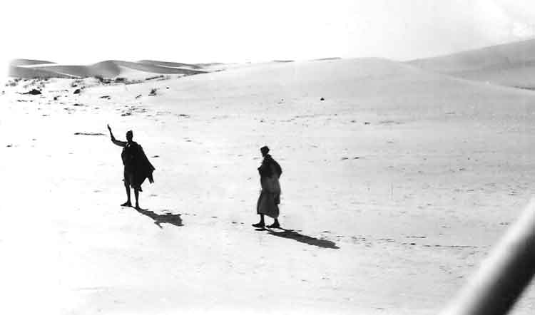
Find the camel - Apr49.
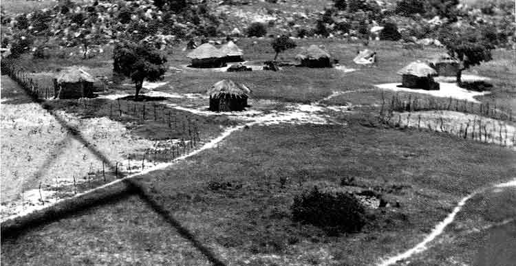
Two views of WOG village near the camp - Apr49.
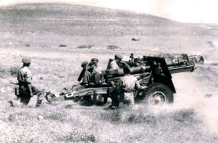
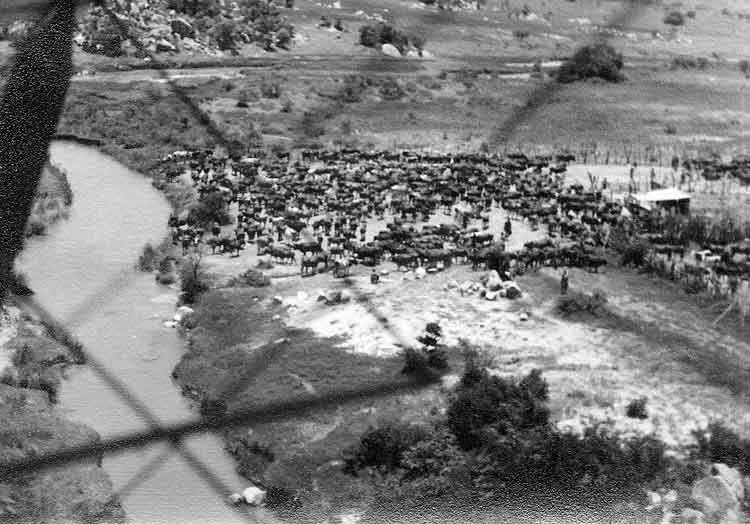
Full recoil- 25 pounder firing on the Garian Range - 2-22Apr49. Thanks to Ian O'Neil we now know that this is why the AOP Sqn was deployed - so that they could provide spotting support for the RA 1 Inf Div plus attached artillery units during their annual practice camp on these ranges at Garian.
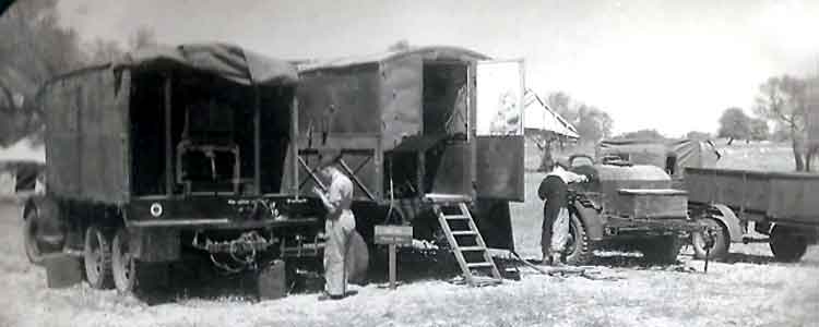
Generator and Photographic Trailer - Apr49.
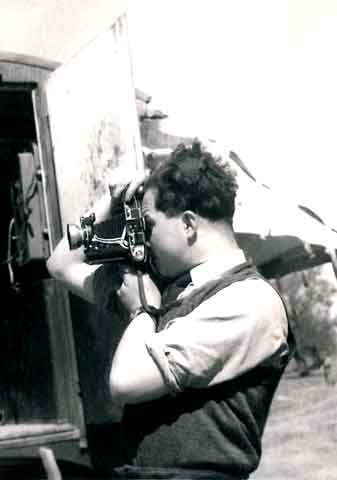
BeBe at work on the Garian Air Strip - Apr49.
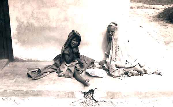
Bucksheesh!? - Apr49.
CO of 651 AOP Squadron, Major Norman-Walker MBE MC RA, with Brig C.H.Colquhoun OBE, the Commander Royal Artillery at Garian - 22Apr49. Thanks to Ian O'Neil's contribution, we learnt that: "Between 9th - 12th some of the aircraft began 'oiling up' but this was rectified by incorporating a piston ring modification. On 22nd Exercise Obliteration was staged by RA 1 Inf Div to demonstrate artillery fire power and Capt Creese-Parsons RA displayed a typical Type A Section complete with MT and relevant equipment. After the display the CO, Major Norman-Walker MBE MC RA, led a Squadron formation flypast over the assembled spectators." Ian also tells us: "The ORB for 651 Sqn (Piece No. AIR 27/2530) mentions Brig C.H.Colquhoun OBE as being CRA 1 Inf Div on 3Feb49 and again on 16May49. These dates bracket the era in question so I think he is the man you are looking for?"
Commander Royal Artillery (abbreviated CRA) was a military appointment in Commonwealth infantry and armoured divisions in the 20th Century. The CRA was the senior artillery officer in the division and commanded the regiments of field, anti-aircraft and anti-tank artillery, and provided specialist artillery and offensive support advice to the divisional commander. Even though the Canadians, New Zealanders, etc. had their own artillery corps (i.e. the Royal Regiment of Canadian Artillery), the term CRA was still used to mark this appointment in formations of those armies (rather than CRCA or CRNZA etc.) for consistency between the allies. The CRA was ranked as a Brigadier General in the First World War, and as a Brigadier in the Second World War.
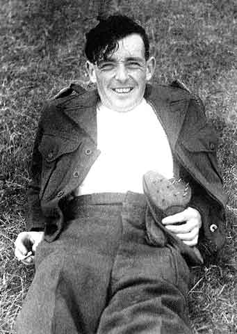
Quick Fag! - Apr49.
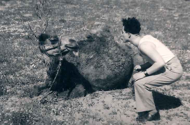
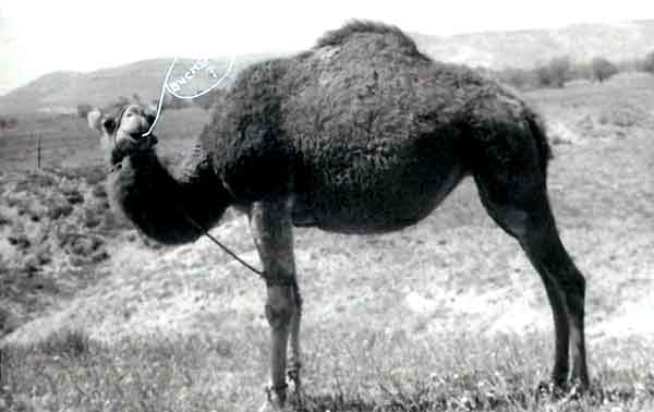
This week's quiz -"Which one is the camel?" - Apr49.
Capt. Malet gets daring (Ground to air shot).
Chuffed I should say so! Home to England for only £50, (Jun13 prices £1,014), for a spot of leave!.
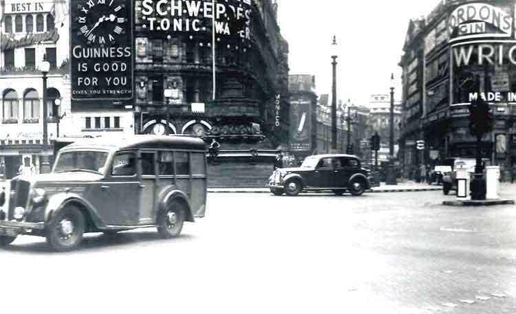
Heart of London - Piccadilly - traffic was a bit less in June 1949!
Piccadilly Circus is a road junction and public space of London's West End in the City of Westminster, built in 1819 to connect Regent Street with the major shopping street of Piccadilly. In this context, a circus, from the Latin word meaning "circle", is a round open space at a street junction. Piccadilly now links directly to the theatres on Shaftesbury Avenue, as well as the Haymarket, Coventry Street (onwards to Leicester Square), and Glasshouse Street. The Circus is close to major shopping and entertainment areas in the West End. Its status as a major traffic intersection has made Piccadilly Circus a busy meeting place and a tourist attraction in its own right. The Circus is particularly known for its video display and neon signs mounted on the corner building on the northern side, as well as the Shaftesbury memorial fountain and statue of the Greek god Anteros (popularly mistaken for his brother Eros). It is surrounded by several noted buildings, including the London Pavilion and Criterion Theatre. Directly underneath the plaza is Piccadilly Circus tube station, part of the London Underground system. At the southwestern side of the Circus, moved after World War II from its original position in the centre, stands the Shaftesbury Monument Memorial Fountain, erected in 1892-1893 to commemorate the philanthropic works of Lord Shaftesbury, who was a famous Victorian politician and philanthropist. The monument is topped by Alfred Gilbert's winged nude statue of the Greek god Anteros, sometimes referred to as The Angel of Christian Charity and popularly mistaken as his brother, Eros. The statue has become a London icon: a graphical illustration of it is used as the symbol of the Evening Standard newspaper and appears on its masthead. The use of a nude figure on a public monument was controversial at the time of its construction, but it was generally well received by the public. The Magazine of Art described it as "...a striking contrast to the dull ugliness of the generality of our street sculpture, ... a work which, while beautifying one of our hitherto desolate open spaces, should do much towards the elevation of public taste in the direction of decorative sculpture, and serve freedom for the metropolis from any further additions of the old order of monumental monstrosities." The statue was the first in the world to be cast in aluminium and is set on a bronze fountain, which itself inspired the marine motifs that Gilbert carved on the statue. While the statue is generally believed to depict Eros, it was created as an image of his twin brother, Anteros. The sculptor Alfred Gilbert had already sculpted a statue of Anteros and, when commissioned for the Shaftesbury Memorial Fountain, chose to reproduce the same subject, who, as "The God of Selfless Love" was deemed to represent the philanthropic 7th Earl of Shaftesbury suitably. Gilbert described Anteros as portraying "reflective and mature love, as opposed to Eros or Cupid, the frivolous tyrant." The model for the sculpture was Gilbert's studio assistant, a 16-year-old Italian, Angelo Colarossi (born 1875).
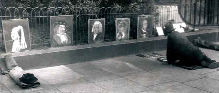
Artful Character - might be the railings round Green Park on the South side of Piccadilly which is an enormous street artists area today? - Piccadilly, Jun49.
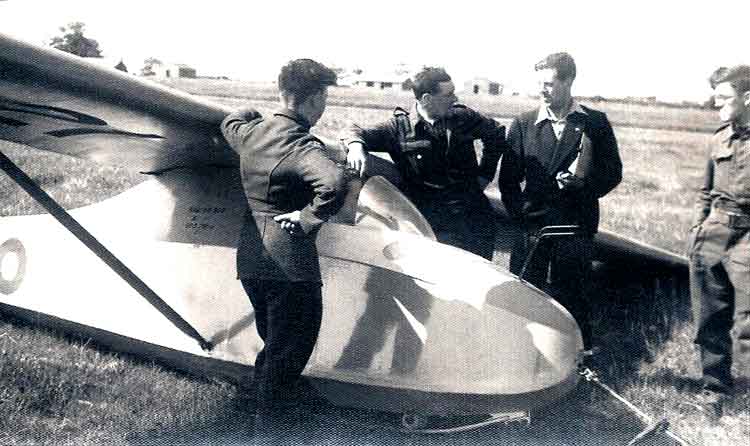
Grunau Baby glider on the Gliding School at Norwich - May49.
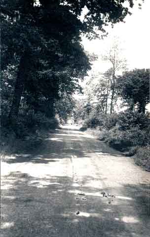
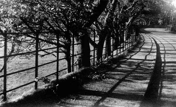
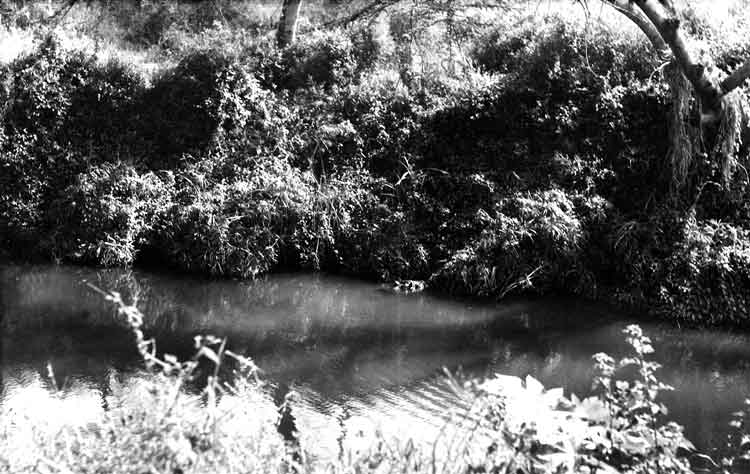
Country Road - Norfolk.
Sight for returning airman!.
Old Tom again - Liverpool Jun49.
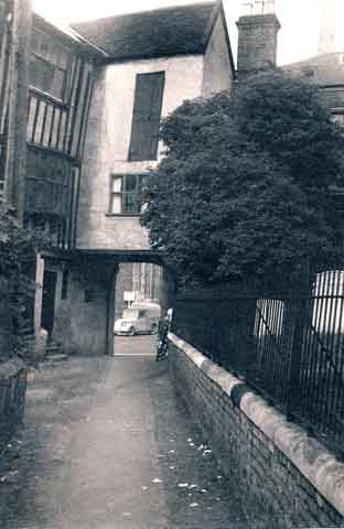
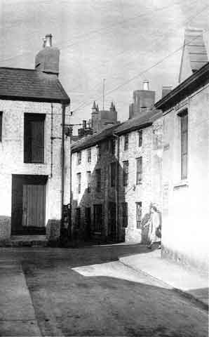
Alley in Norwich - Jun49.
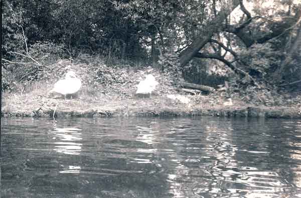
Swans on Wroxham Broad - Jun49.
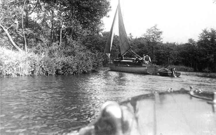
Norfolk Broads Wroxham - Jun49.
Kensington Gardens - Lowestoft.
No Title!.
BeBe in Hyde Park, London.
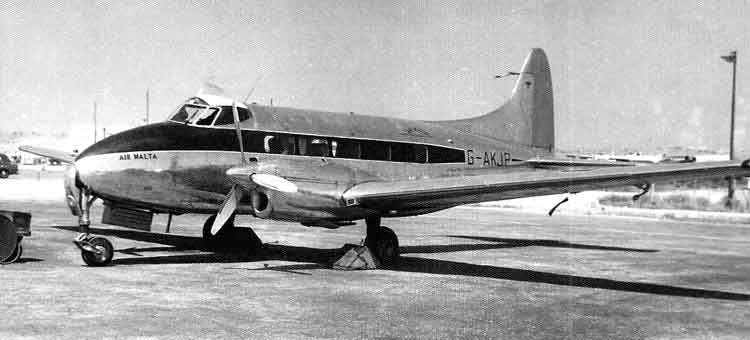
Air Malta modernises with de Havilland DH.104 Dove. BeBe Returns from leave through Malta and back to Tripolitania,
de Havilland DH-104 Dove/Devon
The de Havilland DH.104 Dove was a British monoplane short-haul airliner from de Havilland, the successor to the biplane de Havilland Dragon Rapide and one of Britain's most successful post-war civil designs. The design came about from the Brabazon Committee report which called for a British designed short-haul feeder for airlines. Production of the Dove and its variants totalled 542 including 127 military Devons and 13 Sea Devons. The first customer deliveries were made in early summer 1946 and the last example was delivered in 1967. Initial production of the Dove was at de Havilland's Hatfield factory, but from the early 1950s most were built at the company's Broughton facility near Chester. The Dove first flew on 25Sep45. From summer 1946 large numbers were sold to scheduled and charter airlines around the world, replacing and supplementing the pre-war designed de Havilland Dragon Rapide and other older designs. LAN Chile took delivery of twelve examples and these were operated within that country from 1949 until sale to small United States airlines in 1954. The largest order for Doves was placed by Argentina which took delivery of 70 which were mainly used by the Argentine Air Force. An initial batch of 30 Devons was delivered to the Royal Air Force and these were used as VIP and light transports for over 30 years. The Royal New Zealand Air Force acquired 30 Devons between 1948 and 1954 and these remained in service for VIP, crew-training and light transport duties into the 1970s. A Dove was used by Biafran Air Force during the Nigerian Civil War, and its wreck was found in 1970 in the court of a school in Uli; a second US-registered Riley Dove N477PM delivered in 1967 to Port Harcourt from Switzerland never reached Biafra because it was stopped by Algerian authorities. A few Doves and civilianised Devons remain in use in 2011 in the United Kingdom, Canada, Germany and elsewhere with small commercial firms and with private pilot owners, including the Devon21 syndicate (after RNZAF Devon s/n NZ1821) operating from North Shore Airfield, near Auckland, New Zealand. RAF versions: Dove 4 : Military transport and communication version. Devon C Mk 1: Transport and communication version for the RAF. Devon C Mk 2 : Transport and communications version for the RAF. Re-engined version of the Devon C Mk 1. Sea Devon C Mk 20 : Transport and communications version for the Royal Navy. Specification applies to Dove 7.
Crew: 2; Capacity: 8 passengers; Length: 39 ft 3 in (11.96 m); Wingspan: 57 ft 0 in (17.40 m); Height: 13 ft 4 in (4.06 m); Wing area: 335 sq ft[11] (31.1 m�); Empty weight: 6,325 lb (2,869 kg); Max. takeoff weight: 8,950 lb (4,060 kg); Powerplant: 2 de Havilland Gipsy Queen 70 Mk 3 6-cylinder in-line inverted air-cooled engine, 400 bhp (289 kW) each; Performance; Max speed: 230 mph (200 knots, 370 km/h); Cruise speed: 187 mph (163 knots, 301 km/h) at 8,000 ft (2,440 m) (econ cruise); Stall speed: 74 mph (64 knots, 119 km/h); Range: 880 mi (765 nm, 1,415 km); Service ceiling: 21,700 ft (6,610 m); Rate of climb: 1,135 ft/min (5.8 m/s) (Data from Jane's All The World's Aircraft 1966-67) (Thanks to Wikipedia).
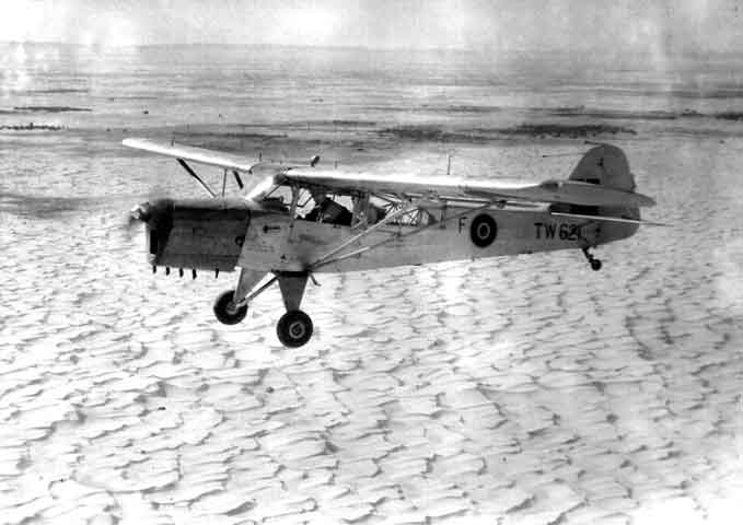
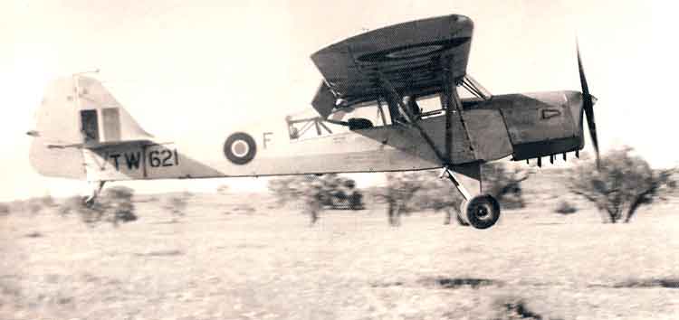
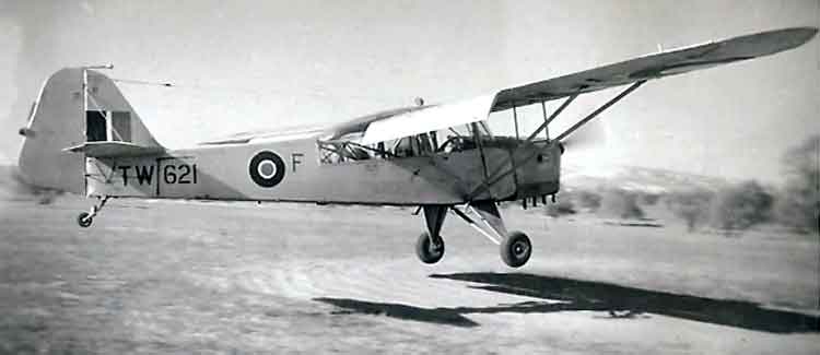
Over the Sea of Sand - Captain Spencer flying Auster Mk.6 TW621 - 3Jul49.
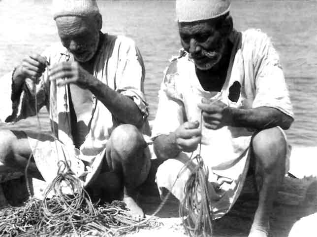
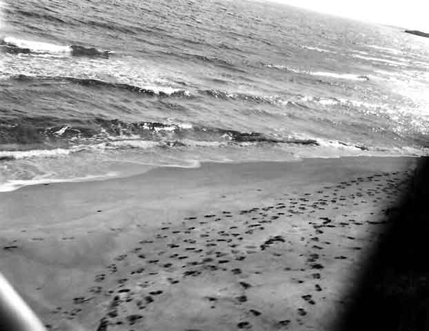
Arab fishermen preparing for the evening.
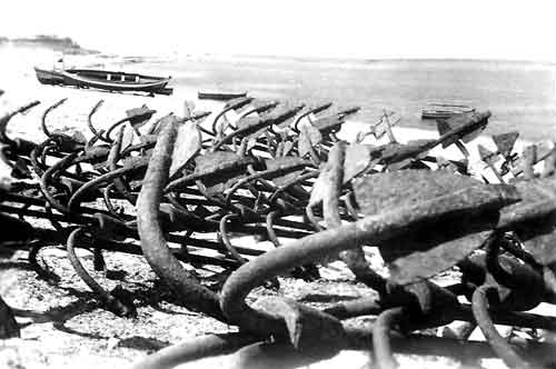
Anchors Aweigh.
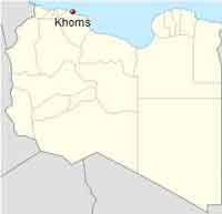
Market Day at Khoms, Libya.
Khoms or Al Khums is a city and port in Murqub District on the Mediterranean coast of Libya with an estimated population of around 202,000. The population at the 1984 census was 38,174. Between 1983 and 1995 it was the administrative center of the Khoms District. The city has Phoenician and Roman roots and became the capital of the Roman province of Africa in the reign of Emperor Septimius Severus. Approximately 3 km (1.9 mi) to the east is the ancient Roman city of Leptis Magna. During the Libyan civil war, rebels from Misrata entered the city without any resistance as the city already fell on 20 August before moving on to Tripoli.
NAAFI Break at Leptis Magna- 10Jul49.
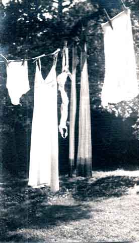
Getting the Laundry Done.
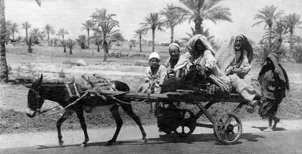
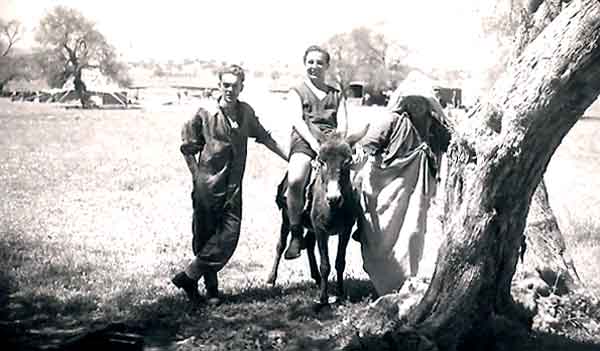
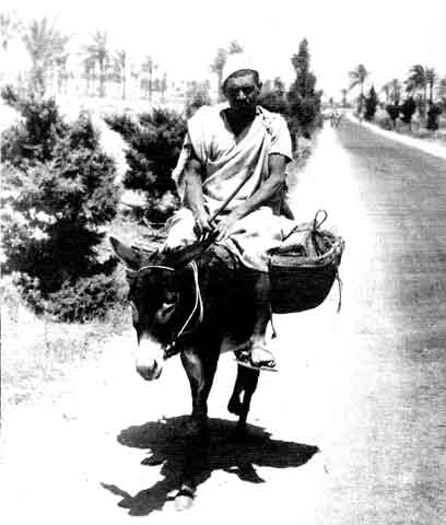
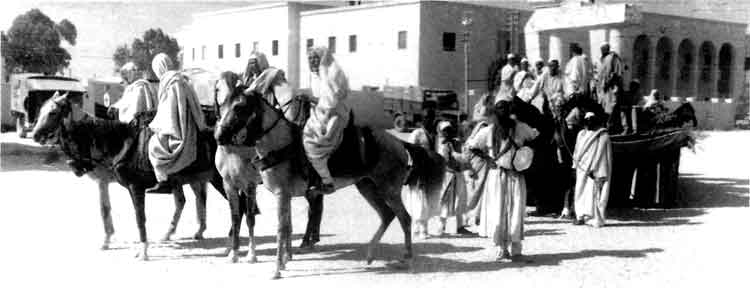
Let all the males ride - the woman can walk!!
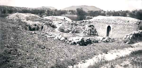
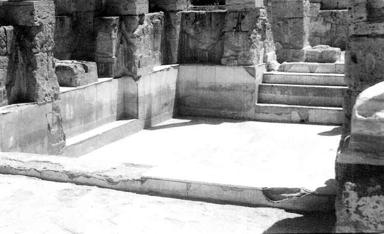
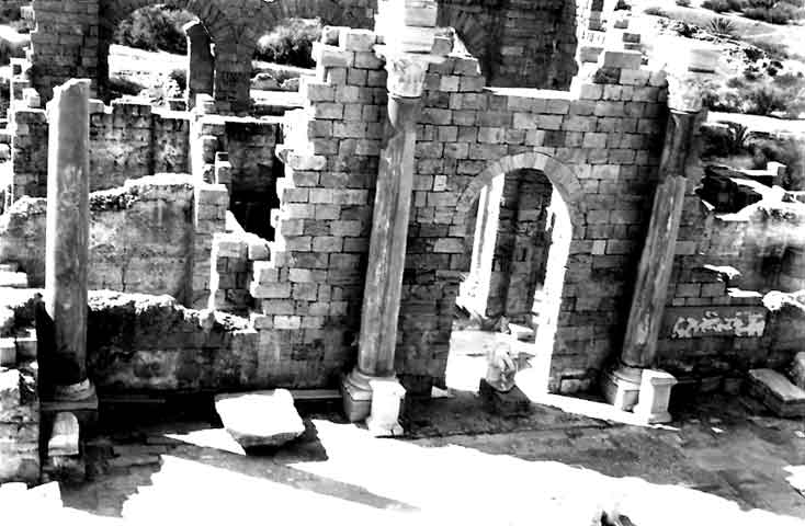
Leptis Magna, Khoms Roman Remains - 10Jul49. BeBe taken in the bottom of the Theatre.
Leptis Magna also known as Lectis Magna (or Lepcis Magna as it is sometimes spelled), also called Lpqy, Neapolis, Lebida or Lebda to modern-day residents of Libya, was a prominent city of the Roman Empire. Its ruins are located in Khoms, Libya, 130 km (81 mi) east of Tripoli, on the coast where the Wadi Lebda meets the sea. The site is one of the most spectacular and unspoiled Roman ruins in the Mediterranean. Part of an ancient temple was brought from Leptis Magna to the British Museum in 1816 and installed at the Fort Belvedere royal residence in England in 1826. It now lies in part of Windsor Great Park. The ruins are located between the south shore of Virginia Water and Blacknest Road close to the junction with the A30 London Road and Wentworth Drive.
Leptis Magna, Khoms Roman Remains - 10Jul49. Portion of frieze.
Leptis Magna, Khoms Roman Remains - 10Jul49. Warm baths - 100 AD.
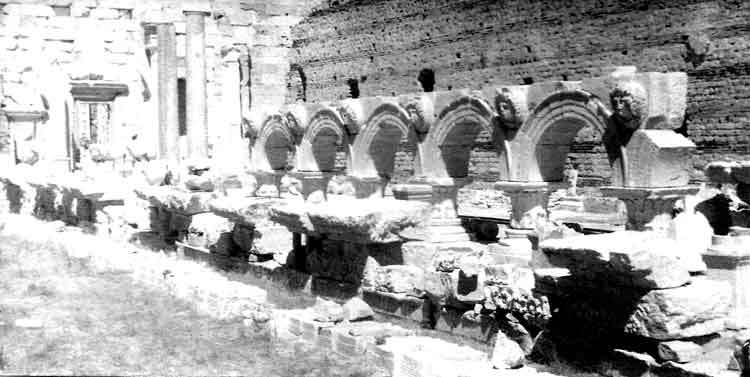
Leptis Magna, Khoms Roman Remains - 10Jul49. Forum built by Septimus Severus in AD 200.
Leptis achieved its greatest prominence beginning in 193, when a native son, Lucius Septimius Severus, became emperor. He favored his hometown above all other provincial cities, and the buildings and wealth he lavished on it made Leptis Magna the third-most important city in Africa, rivaling Carthage and Alexandria. In 205, he and the imperial family visited the city and received great honors. Among the changes that Severus introduced were to create a magnificent new forum and to rebuild the docks. The natural harbour had a tendency to silt up, but the Severan changes made this worse, and the eastern wharves are extremely well preserved, since they were hardly used.
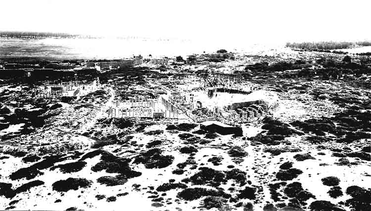
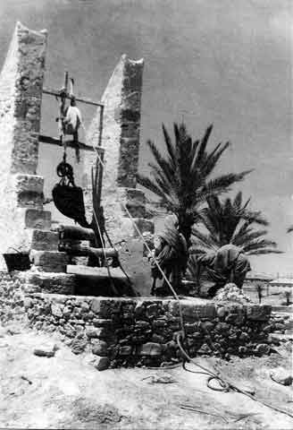
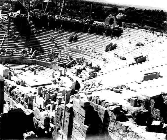
Leptis Magna, Khoms Roman Remains - 10Jul49. Aerial View of Theatre. BeBe notes in his album: "Please note that these photographs are aerial Views, in the true sense of the word. (They were taken from a low flying Auster and NOT taken from step ladders!!)"
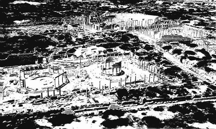
Leptis Magna, Khoms Roman Remains - 10Jul49. Aerial View of Theatre.
Leptis became a provincial capital of the Eastern Roman Empire but never recovered from the destruction wreaked upon it by the Berbers. It was the site of a massacre of Berber chiefs of the Leuathae tribal confederation by the Roman authorities in 543. By the time of the Arab conquest of Tripolitania in the 650s, the city was abandoned except for a Byzantine garrison force.
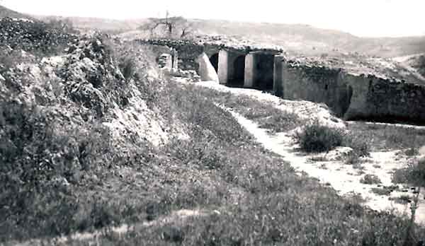
Leptis Magna, Khoms Roman Remains - 10Jul49. Low level obliques.
Leptis Magna, Khoms Roman Remains - 10Jul49. Low level aerial shot of Theatre.
Leptis Magna, Khoms Roman Remains - 10Jul49. Another Low level aerial shot of Theatre.
Leptis Magna, Khoms Roman Remains - 10Jul49. More Distant Low level aerial shot of Theatre.
Auster Pages - Taking off, Flying, Landing, Just standing there - Photographs of Auster Aircraft, taken at 651 AOP Sqn, RAF Castel Benito.
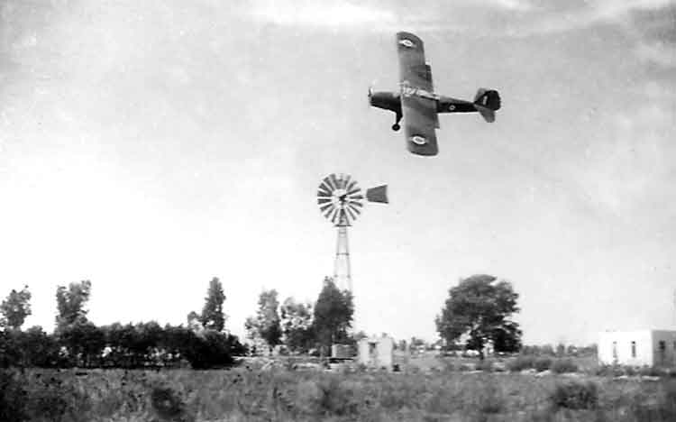
Auster avoiding a Tripolitanian windmill - 651 AOP Sqn, RAF Castel Benito.
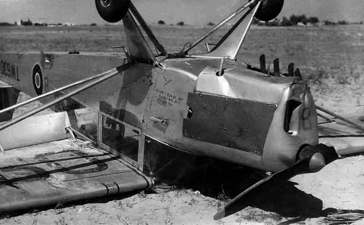
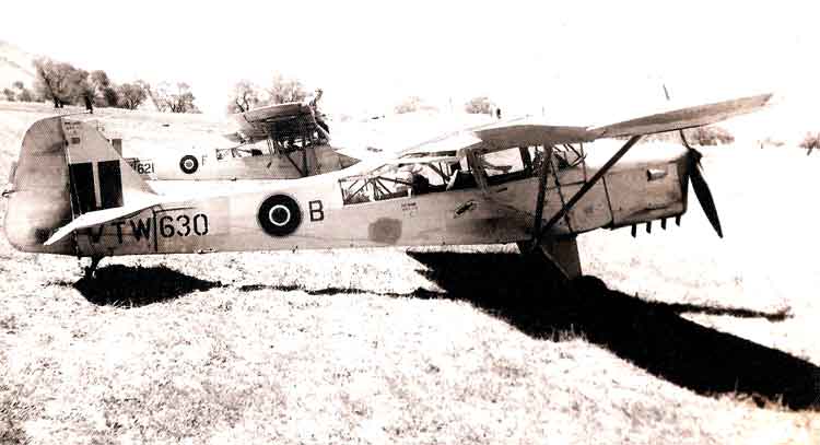
Thursday 25Aug49 Auster AOP6 TW630 from 651 Sqn crashed one mile North of Bianchi/Marmura (map ref 195510), Libya, no injuries. The aircraft was on a low level cross country sortie at 0730 hrs when the engine failed, due to the fracture of the No 4 cylinder rocker bracket securing bolts, which sheared because a modification had not been embodied. The pilot carried out a forced landing in open country but the aircraft ran into soft sand at the end of its landing run and turned over. The pilot, Capt D.I.A.McKechnie RA, and passenger, R.F. De Meyer, were uninjured (Form 1180). (E-mail received on 3Feb21: "Dear Mr. Ryan, I spent some time recently searching about an aircraft that that my father was in. He was in the RAF, a fitter, and in 1949 he was in Libya with 651 squadron working on Austers. We heard the story about this particular incident from a young age, with a dog eared photo of the plane to back it up. I was extremely pleased to find a copy on your website, with a little more information, sadly though not the name of the observer, my father. Is it possible to update this with his name? (R.F. De Meyer) It is in faded ink on the photo, along that of the pilot. His daughter told him that his name had been added to the web site and she reported: "He gave a massive smile when I told him. I read it all out to him as well. Told him his name was now in the history books." He was terminally ill and passed away on 5Feb21.)
Auster from 651 AOP Sqn, RAF Castel Benito.
Auster from 651 AOP Sqn, over the desert, RAF Castel Benito.
1910 Flight, 651 AOP Sqn, RAF Castel Benito.
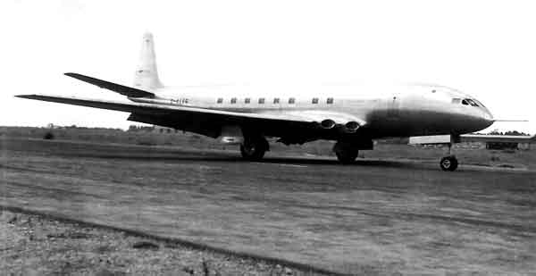
UK to Tripoli in 3½ hours! de Havilland DH106 Comet.
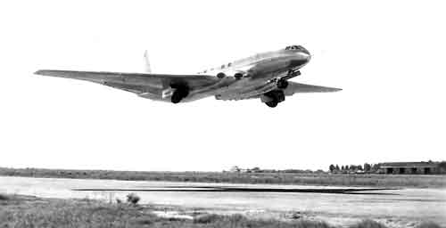
de Havilland DH.106 Comet taking off from RAF Castel Benito, (Tripoli International today).
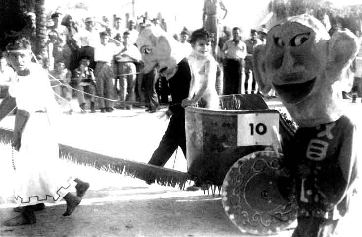
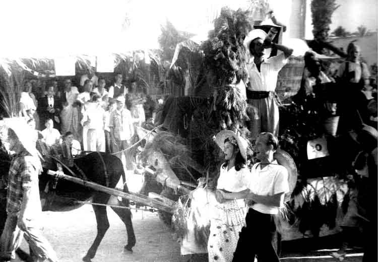
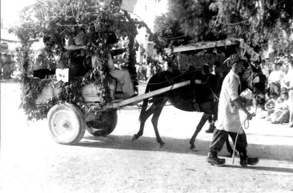
Grape Harvest Festival at Zavia - Aug49.
Zawiya is a city in northwestern Libya, situated on the Libyan coastline of the Mediterranean Sea about 45 km (28 mi) west of Tripoli, in the historic region of Tripolitania. Zawiya is the capital of the Zawiya District. In the Libyan censuses of 1973 and 1984, the city counted about 91,603 inhabitants; it was then - and possibly continues to be today - the fifth largest city in Libya by population (after Tripoli, Benghazi, Misrata and Bayda). In 2011, Zawiya was estimated to have a population of about 200,000 people, most of whom were concentrated in the city. Zawiya has a university named the Al Zawiya University, founded in 1988. There is also an oil field near the city and Zawiya has one of the two most important oil refineries in Libya. Zawiya was the site of some of the fiercest fighting in the Libyan civil war, as it controls the vital route between the national capital Tripoli and the Tunisian border.
"In Vino Veritas" won 3rd Prize - Aug49.
2nd Prize - "Bacchanalia" (Sobratha).
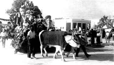
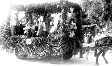
1st Prize - "The Contented Faun" - Aug49.
At this festival about 2 tons grapes and 2,500 litres of wine were consumed! A competition for the best decorated wagon was won by this one, "The Contented Faun", while the second prize as given to "Bacchanalia" below
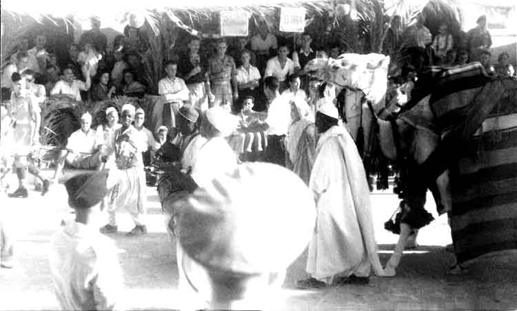
Another View of "Bacchanalia".
Happy go lucky - Aug49.
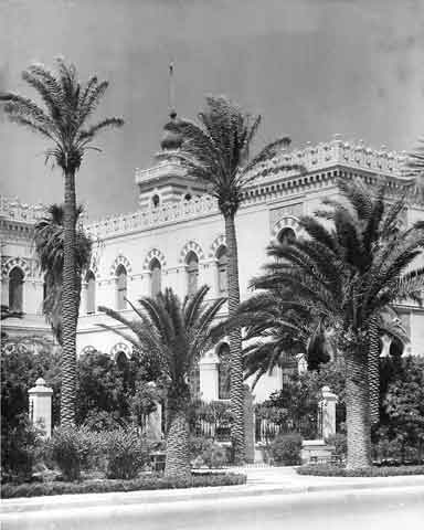
Bank of Rome, Tripoli.
The Hills Near Jeffron from 3,000ft.
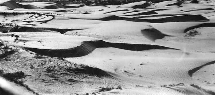
The Edge of the Desert - These 3 photographs were taken from a low flying Auster with a "K20" camera 1/500th at f11.
Siyeda - Oh Noisy Bird!.
Land and Sea from the air - just!
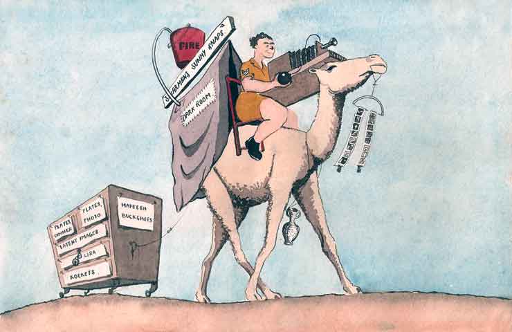
Figg's Impression of Mobile Photographic Section - 8Aug49.
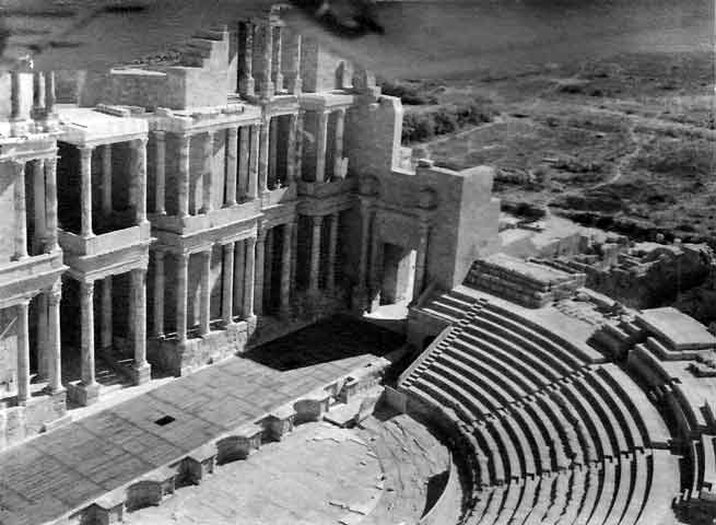
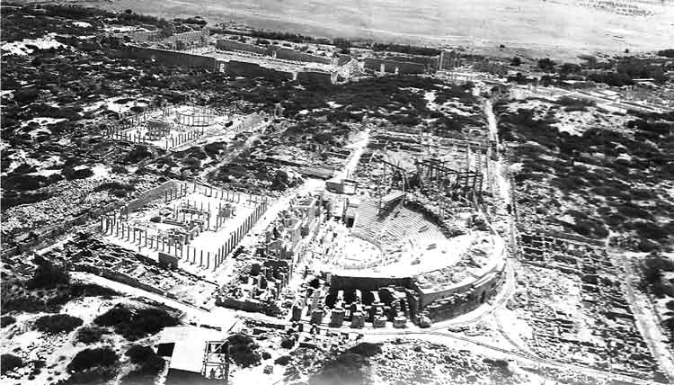
The Theatre at Sabratha from the Air.
Sabratha, Sabratah or Siburata, in the Zawiya District in the northwestern corner of modern Libya, was the westernmost of the "three cities" of Tripolis. From 2001 to 2007 it was the capital of the former Sabratha wa Sorman District. It lies on the Mediterranean coast about 66 km (41 mi) west of Tripoli. The extant archaeological site was inscribed as a UNESCO World Heritage Site in 1982. Sabratha's port was established, perhaps about 500 BC, as a Phoenician trading-post that served as a coastal outlet for the products of the African hinterland. The Phoenicians gave it the Lybico-Berber name 'Sbrt'n', which suggests that there may have been a native town built there prior to the Phoenicians' arrival. Sabratha became part of the short-lived Numidian Kingdom of Massinissa before being Romanized and rebuilt in the 2nd and 3rd centuries AD. The Emperor Septimius Severus was born nearby in Leptis Magna, and Sabratha reached its monumental peak during the rule of the Severans. The city was badly damaged by earthquakes during the 4th century, particularly the quake of AD 365. It was rebuilt on a more modest scale by Byzantine governors. Within a hundred years of the Arab conquest of the Maghreb, trade had shifted to other ports and Sabratha dwindled to a village. Besides its magnificent late 3rd century theatre that retains its three-storey architectural backdrop, Sabratha has temples dedicated to Liber Pater, Serapis and Isis.
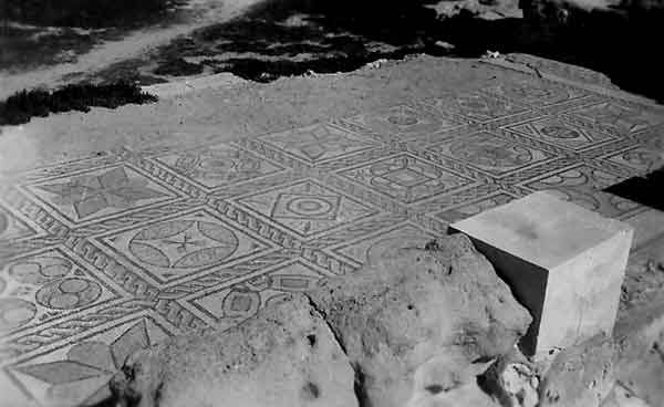
One of the Many Beautiful Mosaics at Sabratha. There is a Christian basilica of the time of Justinian and also remnants of some of the mosaic floors that enriched elite dwellings of Roman North Africa (for example, at the Villa Sileen, near Khoms). However, these are most clearly preserved in the coloured patterns of the seaward (or Forum) baths, directly overlooking the shore, and in the black and white floors of the Theatre baths.
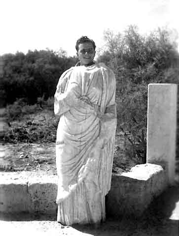
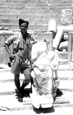
Statue of Emperor ANTONINUS SHARMAN (an ancestor of mine).
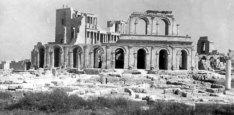
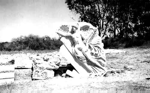
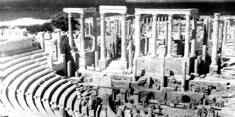
Another View of the Theatre at Sabratha.
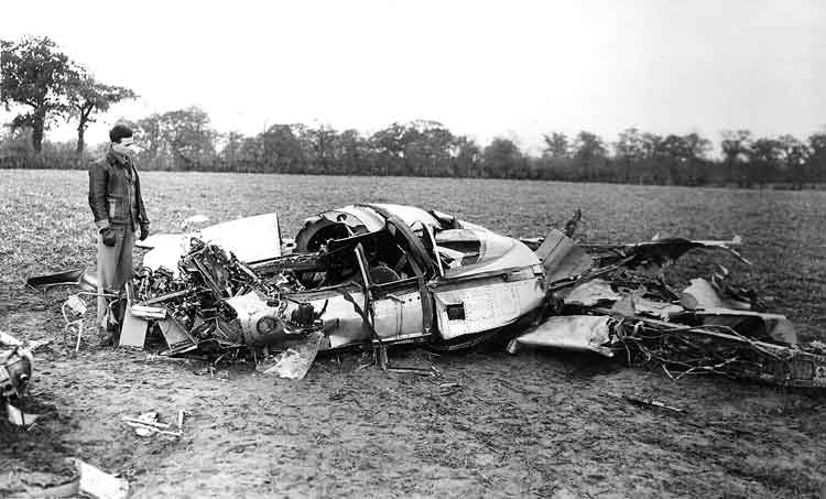
BeBe Back to England for Flying Training. Encouragement for one returning for aircrew course - Meteor crash near Norwich.
Probably 14Sep50 Meteor T.7 VW431 from CFE. The aircraft was involved in a mid-air collision with a USAF Sabre F-86D serial number 48-754. Both aircraft dived into the ground at Wendling 18 miles North-West of Norwich. Flt Lt Ronald William Happe was killed. (It looks like a Meteor T.7 long cockpit?)
BeBe pouring "Frozen" beer at No 5 Personnel Despatch Centre Hednesford from Jan to Jun50. He was also at Hednesford after Jurby in Dec50 while waiting to go to Flying Training at RAF Heany in Southern Rhodesia.
BeBe's new job - X-Ray Section at Hednesford Jan to Jun50 before he went Air Crew Transit Unit at Driffield in Yorkshire.
Smutty joke.
Afternoon Stroll in Webbing - Preliminary Training before leaving for the Isle of Man. ACTU Driffield, Yorkshire - Jun50.
Example of BeBe's talent for Artwork from his Album.
Keen to get on the boat to the Isle of Man!
The Isle of Man; Manx: Ellan Vannin, otherwise known simply as Mann (Manx: Mannin, is a self-governing British Crown Dependency, located in the Irish Sea between the islands of Great Britain and Ireland. The head of state is Queen Elizabeth II, who holds the title of Lord of Mann. The Lord of Mann is represented by a Lieutenant Governor, but its foreign relations and defence are the responsibility of the British Government. Although the United Kingdom does not usually intervene in the island's domestic matters, its "good government" is ultimately the responsibility of the Crown (that is, in practice, the Government of the United Kingdom). The island has been inhabited since before 6500 BC. As one of the six Celtic nations, Gaelic cultural influence began in the 5th century AD, and the Manx language, a branch of the Gaelic languages, gradually emerged. In 627, Edwin of Northumbria conquered the Isle of Man along with most of Mercia. In the 9th century, the Norse began to settle there. Norse people from Scotland then established the Kingdom of the Isles. The King's title would then carry the suffix, "and the Isles." Magnus III, the King of Norway, was also known as "King of Man and the Isles" as part of the Hebrides civilization between 1099 and 1103. A Norse-Gaelic culture arose and the island came under Norse control. In 1266, the island became part of Scotland, as formalised by the Treaty of Perth. After a period of alternating rule by the kings of Scotland and England, the island came under the feudal lordship of the English Crown in 1399. The lordship revested into the British Crown in 1764, but the island never became part of the Kingdom of Great Britain or its successor the United Kingdom, retaining its status as an internally self-governing Crown dependency.
Loading the Kits up.
RAF Camp Jurby from a dual glider. (1/400 @ f16). Bebe was at No 1 ITS RAF Jurby from Jun50 until Nov50.
View of Ramsey.
Ramsey (Manx: Rhumsaa) is a town in the north of the Isle of Man. It is the second largest town on the island after Douglas. Its population is 7,309 according to the 2006 census (7,322, 2001 census). It has one of the biggest harbours on the island, and has a prominent derelict pier, called the Queen's Pier. It was formerly one of the main points of communication with Scotland. Ramsey has also been a route for several invasions by Vikings and Scots. Ramsey is also known as 'Royal Ramsey' due to royal visits from Queen Victoria and Prince Albert in 1847 followed by King Edward VII and Queen Alexandra in 1907.
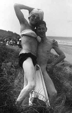
Boys will be Girls!! - Swimming at Jurby Head Isle of Man.
Jurby (Manx: Jourbee) is a parish in Michael Sheading in the Isle of Man and has, according to the 2006 census, 659 (2001 census 677) residents. It is largely an agricultural district on the north-north-western coast of the island but also has an industrial park on the old RAF Jurby Airfield. Airfield Jurby Airfield was originally used as a Royal Air Force training base in World War II. During the 1950s it was used as a training camp for Officer cadets on short term commissions in the RAF. The course lasted 3 months. Part is now used as an industrial and retail estate. The old runways and taxiways now form the Jurby motorcycle race track. Jurby Transport Museum:
A museum dedicated to transport of the Isle of Man, the Jurby Transport Museum, is housed in an old aircraft hangar. Prison: The Isle of Man Prison operated by the Isle of Man Prison Service is located at Jurby. RAF Jurby Head: an offshore air weapons range operational between 1939 and 1993.
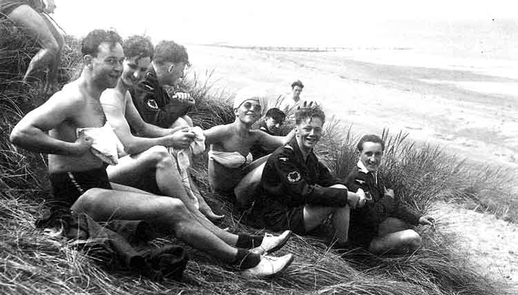
Swimming at Jurby Head Isle of Man.
Teach him to lie in bed!
Back street in Ramsey.
You won't catch much here! Douglas Harbour Aug50.
Douglas (Manx: Doolish) is the capital and largest town of the Isle of Man, with a population of 28,939 people (2011). It is located at the mouth of the River Douglas, and a sweeping bay of two miles. The River Douglas forms part of the town's harbour and main commercial port. Douglas was a small settlement until rapid growth occurred as a result of links with the English port of Liverpool in the 18th century. Further population growth came as the town industrialized in the following century, resulting in 1869 with the island's government, the Tynwald, relocating to Douglas from Castletown. The island's High Courts are also based in the capital. The town serves as the Island's main hub for business, finance, legal services, shipping, transport, shopping, and entertainment. The annual Isle of Man TT in motorcycle racing starts and finishes in Douglas.
Looking across Douglas Bay, Isle of Man.
Road, Isle of Man.
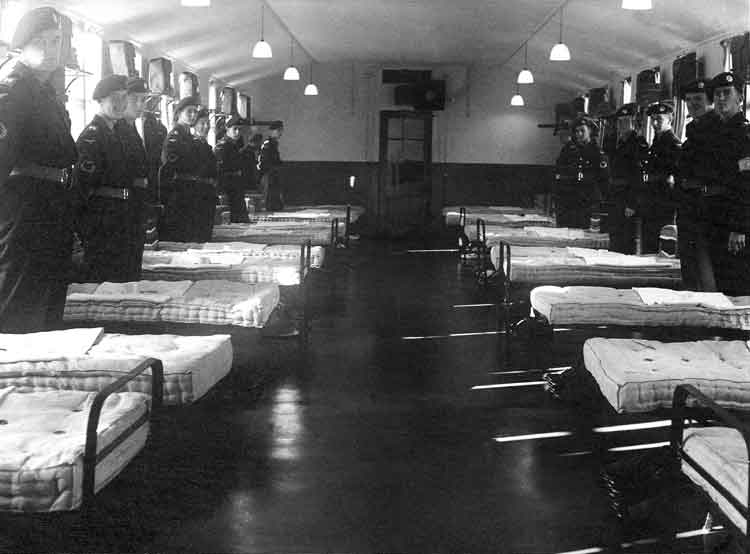
The Billet on Inspection Morning, and....
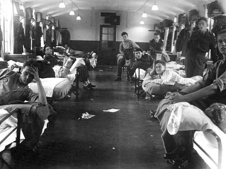
What the Billet looks like on Sunday - Room 19.
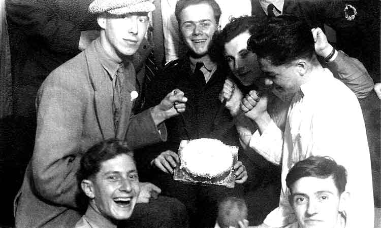
14Ju50 - Just a Shower of Vultures surround BeBe and his cake- Before....
...and After!
The Last Word in Transport! (Manx Toast Racks).
Peel Castle. Peel Castle has been proposed as a possible location of the Arthurian Avalon or as the location of the Grail Castle, site of Lancelot's encounter with the sword bridge of King Melegaunt.
Jock.
Preparing for leaving.
One of the Bisto Kids. Tasting the washing up water.
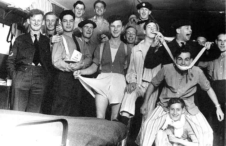
59e Course. You may think that this crowd is mad, but look at the next lot....
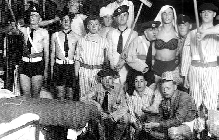
57 Course acting normally.
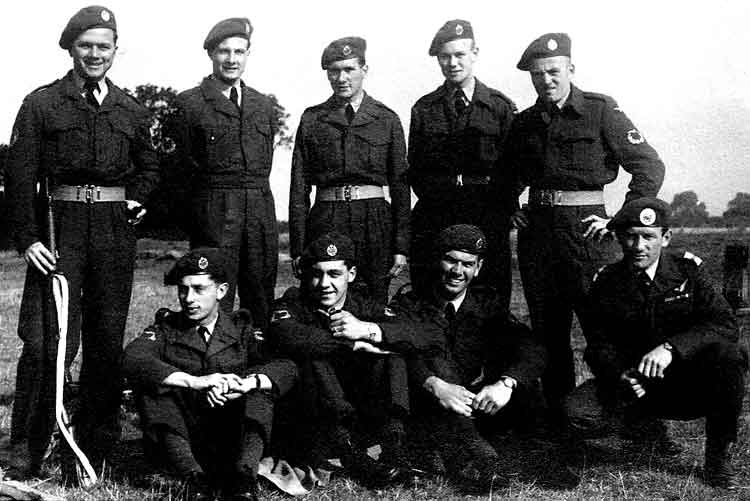
RAF Jurby Rifle Team at the 23 Group Shoot at RAF Syerston Nottinghamshire.
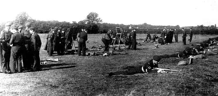
The Range near Newark. 23 Group Shoot.
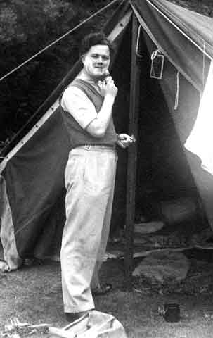
BeBe dwelling under canvas.
The campsite at Ravensdale.
Agin' the light - Peel Harbour.
Mid-Term Dinner - Sep50.
The Solid Core of 59e. L to R: Nick, Tiny, Woody, Jock, BeBe, Johna and Jimmy.
Guess where this was taken? BeBe second from left.
Waiting for the bang. Peel Castle.
Peel Castle is a castle in Peel, Isle of Man originally constructed by Vikings. The castle stands on St Patrick's Isle which is connected to the town by causeway. It is now owned by Manx National Heritage and is open to visitors during the summer. The castle was built in the 11th century by the Vikings, under the rule of King Magnus Barelegs. While there were older stone Celtic monastic buildings on the island, the first Viking fortifications were built of wood. The prominent round tower was originally part of the Celtic monastery, but has had battlements added at a later date. In the early 14th century, the majority of the walls and towers were built primarily from local red sandstone, which is found abundantly in the area. After the rule of the Vikings, the castle continued to be used by the church due to the cathedral built there - the see of Sodor Diocese - but was eventually abandoned in the 18th century. The castle remained fortified and new defensive positions were added as late as 1860. The buildings within the castle are now mostly ruined, but the outer walls remain intact. Excavations in 1982-87 revealed an extensive graveyard as well as the remains of Magnus Bareleg's original wooden fort. The most spectacular finds were the 10th century grave of "The Pagan Lady" which included a fine example of a Viking necklace and a cache of silver coins dating from about 1030. The Castle's most famous "resident" is the so called Moddey Dhoo or Black Dog ghost. Peel Castle features today on the reverse side of the £10 notes issued by the Isle of Man Government.
Woody and BeBe in dual glider.
Peel Castle.
Stormy Weather off Peel Castle.
Sharman - Just as Scruffy!.
Station Gym - Jurby.
So more examples of BeBe's skill.
Fg Off Thompson leaves his mark in a "Gentle Mess Frolic".
59e Course - "Dining In". BeBe is on the right in the front row.
Paddy takes the plunge.
I Do".
WE NOW LEAVE ENGLAND AND MAKE TRACKS FOR SOUTHERN RHODESIA - Dec50
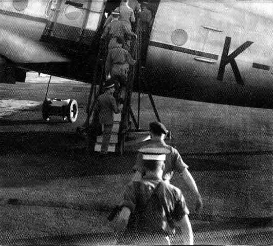
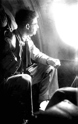
Boarding the Hastings - December 1950.
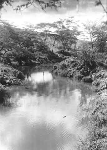
Hippo pool in the park, Kenya - December 1950.
The Banks of the Nile at Khartoum.
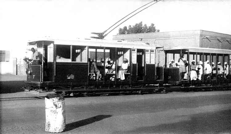
Street Car - Khartoum.
Freddie Smith eats his lunch over the Belgian Congo.
BeBe decides that it is a long way home.
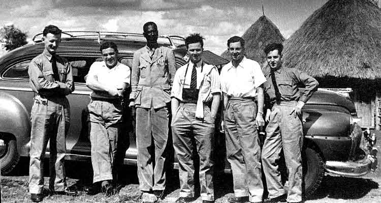
BeBe's safari - he is third from right.
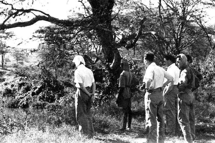
Looking for Hippos.
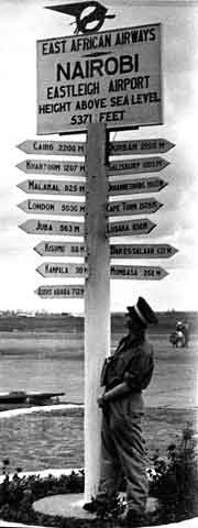
Native carving wooden cutlery at Eastliegh - Dec50.
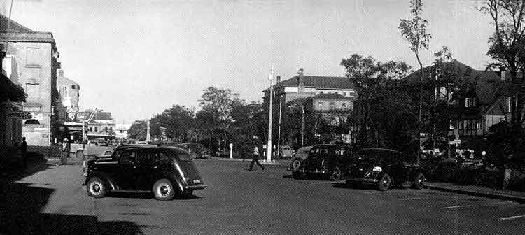
Street in Nairobi - Dec50.
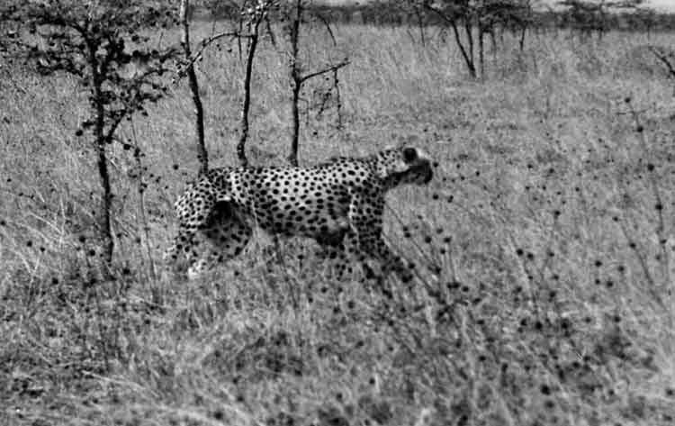
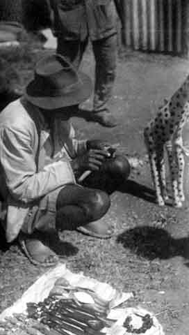
Cheetah in the Reserve, Nairobi - Dec50.
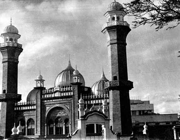
Indian Mosque, Nairobi - Dec50.
Jamia Mosque is a mosque located on Banda Street, Nairobi, Kenya in the Central Business District. The mosque is one of Kenya's most prominent religious structures, and the most important mosque in the country. It was founded and first built by Syed Maulana Abdullah Shah between the year 1902 and 1906. He was a very pious man and up to today he is remembered every year by Muslims. The Mosque has since been extended since its original construction.
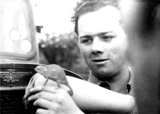
BeBe with Young "Charlie" our chameleon. (The day we found him at Motopas.).
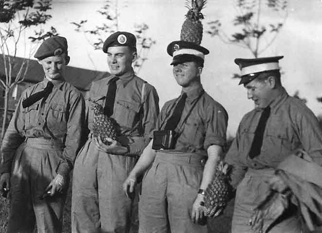
Pineapples are cheap here!! (BeBe second from the right).
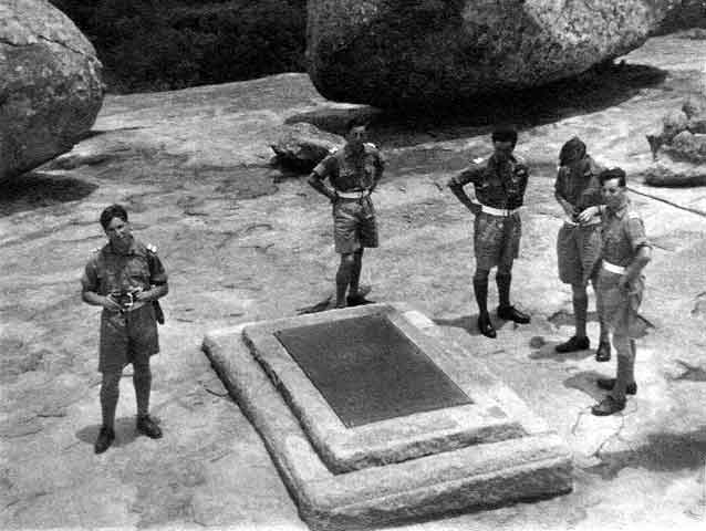
Group round Rhodes Grave.
Cecil John Rhodes PC, DCL (5 July 1853 - 26 March 1902) was an English businessman, mining magnate, and politician in South Africa. He was the founder of the diamond company De Beers, which today markets 40% of the world's rough diamonds and at one time marketed 90%. An ardent believer in British colonialism, he was the founder of the southern African territory of Rhodesia, which was named after him in 1895. South Africa's Rhodes University is also named after Rhodes. He set up the provisions of the Rhodes Scholarship, which is funded by his estate. Historian Richard A. McFarlane has called Rhodes "as integral a participant in southern African and British imperial history as George Washington or Abraham Lincoln are in their respective eras in United States history... Most histories of South Africa covering the last decades of the nineteenth century are contributions to the historiography of Cecil Rhodes." From age 40 his heart condition returned with increasing severity until his death from heart failure in 1902, aged 48, at his seaside cottage in Muizenberg. The Government arranged an epic journey by train from the Cape to Rhodesia, with the funeral train stopping at every station to allow mourners to pay their respects. He was finally laid to rest at World's View, a hilltop located approximately 35 kilometres (22 mi) south of Bulawayo, in what was then Rhodesia. Today, his grave site is part of Matobo National Park, Zimbabwe.
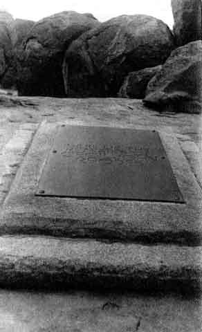
Rhode's Grave, Matopas.
"Up for a breather".
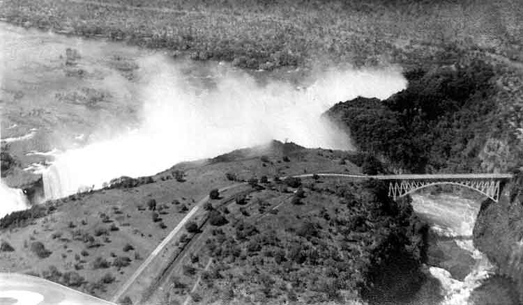
Victoria Falls from the air.
Victoria Falls (or Mosi-oa-Tunya (Tokaleya Tonga: the Smoke that Thunders) is a waterfall in southern Africa on the Zambezi River at the border of Zambia and Zimbabwe. While it is neither the highest nor the widest waterfall in the world, it is classified as the largest, based on its width of 1,708 metres (5,604 ft)[6] and height of 108 metres (354 ft), resulting in the world's largest sheet of falling water. Victoria Falls is roughly twice the height of North America's Niagara Falls and well over twice the width of its Horseshoe Falls. In height and width Victoria Falls is rivalled only by Argentina and Brazil's Iguazu Falls. For a considerable distance upstream from the falls the Zambezi flows over a level sheet of basalt, in a shallow valley, bounded by low and distant sandstone hills. The river's course is dotted with numerous tree-covered islands, which increase in number as the river approaches the falls. There are no mountains, escarpments, or deep valleys; only a flat plateau extending hundreds of kilometres in all directions. European settlement of the Victoria Falls area started around 1900 in response to the desire of Cecil Rhodes' British South Africa Company for mineral rights and imperial rule north of the Zambezi, and the exploitation of other natural resources such as timber forests north-east of the falls, and ivory and animal skins. Before 1905, the river was crossed above the falls at the Old Drift, by dugout canoe or a barge towed across with a steel cable. Rhodes' vision of a Cape-Cairo railway drove plans for the first bridge across the Zambezi and he insisted it be built where the spray from the falls would fall on passing trains, so the site at the Second Gorge was chosen. From 1905 the railway offered accessible travel to whites from as far as the Cape in the south and from 1909, as far as the Belgian Congo in the north. In 1904 the Victoria Falls Hotel was opened to accommodate visitors arriving on the new railway. The falls became an increasingly popular attraction during British colonial rule of Northern Rhodesia (Zambia) and Southern Rhodesia (Zimbabwe), with the town of Victoria Falls becoming the main tourist centre.
A quick smoke!
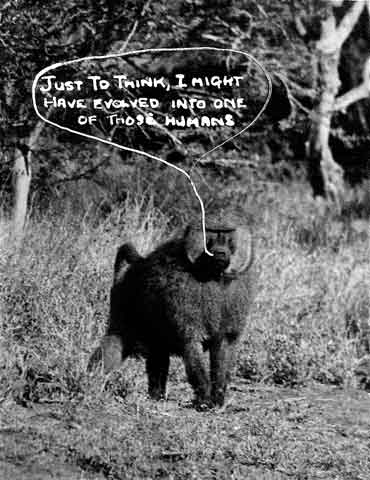
Baboon inspecting humans - Kenya Dec50.
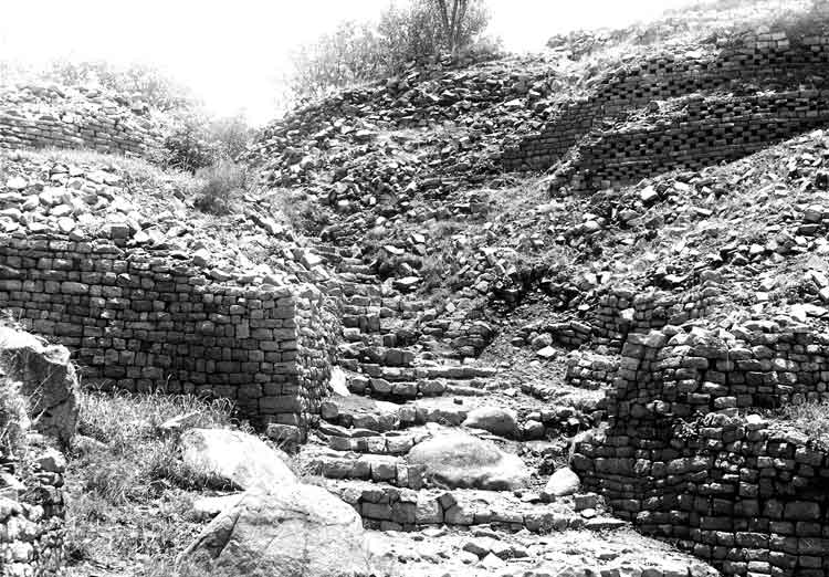
Khami ruins.
Khami (also written as Khame, Kame or Kami) is a ruined city located 22 kilometres west of Bulawayo, capital of the province of Matabeleland North in Zimbabwe. It was once the capital of the Kingdom of Butua of the Torwa dynasty. It is now a national monument, and became a UNESCO World Heritage Site in 1986. The settlement that we see today was a development of the architectural form that emerged at Great Zimbabwe in the 13th century AD and a local Leopard's Kopje culture that built platforms of rough walling on which houses would be constructed. Khami marks an innovation that recognised the environment in which was built. The area around Khami, being riverine, is hot and had problems with malaria. The stone found at Khami (laminar granite) was different from that found in other areas of Zimbabwe (biotite). With a mixture of dolerite, this stone was harder to quarry and produced shapeless building stone. It can be estimated that over 60% of the stone produced at these quarries would not be of building quality. The building blocks thus needed to be shaped, but even then the stones were not suitable for building free-standing dry stone walls. The builders thus made an innovation and produced retaining walls instead. Secondly, building platforms made the houses cooler than those in the open areas below. It also eliminated the problem of malaria for the lucky royals who stayed in the built-up areas. The walls are gravity retaining walls built without mortar. Unlike at Great Zimbabwe, some of the walls at Khami have foundations built with huge blocks which would have been lifted by at least 4 people. Excavations have revealed well-planned buildings especially at the Hill Complex, which was occupied by the king. The complex was first built up by creating terraces of rough walling. These rough walls, which are very stable, were then covered up by quality walling of dressed stone blocks. Each terrace was highly decorated with either a checkboard pattern, herringbone, or a cord pattern. The terraces leaned inwards so that gravity would not cause collapses. The terraces that were created by leaning inwards had wooden poles probably for the guards to hold on to as they walked along the high and steep walls.
View at Khami - Dec50.
Khami Ruins - Dec50.
Native village near Khami.
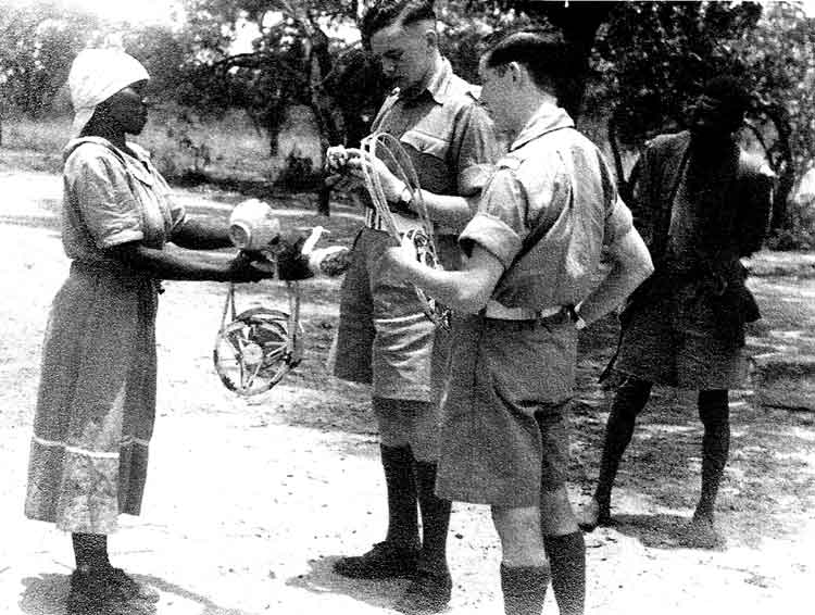
Young Titch does some haggling - Dec50.
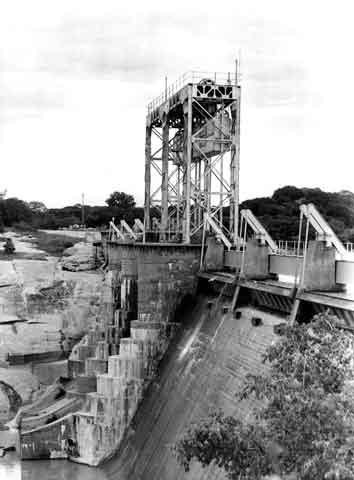
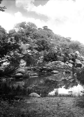
Khami Dam, Bulawayo - Dec50.
About half a mile from the ruins is the Khami Dam which was built in 1928 as a water source for the growing town of Bulawayo. It is now decommissioned as the water is sadly polluted by waste from upstream. It was once a popular fishing and boating venue. May be one day when someone takes responsibility this environmental mess will be cleaned up and recreation can return. If you don't mind the green slim and smell it is excellent to observe a variety of waterfowl.
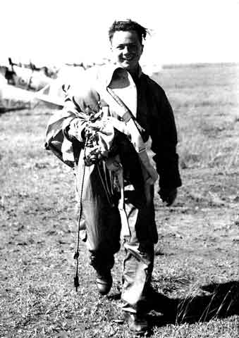
Aviation at last!!! BeBe with his flying gear - Jan51.
Bulawayo.
Near the airfield at Heany.
RAF Heany was home to No 4 Flying Training School and 394 Maintenance Unit in 1948/1949. It was approximately 15 miles from Bulawayo which was the capitol of the then Southern Rhodesia. It operated Tiger Moths and Harvard aircraft.
Messing about at the Hillside Dam.
The Hillside Dams, once the principle source of Bulawayo's water supply, are in easy reach of the centre of town. Although distinct from the Matopo Hills, this area of broken kopjes and sandy open plains resembles the much larger, better-known World Heritage Site. Yet it lies with in the Bulawayo City boundary. Its natural vegetation is still largely intact and includes a wide range of species while the bird life is diverse. The area has attracted people since the earliest of times. It is not surprising that it was the location of one of King Lobengula Khumalo's favourite royal village to which he escaped when the stresses and strains of power at the nearby capital of koBulawayo were too great. More recently it has catered for generations of Bulawayo residents seeking an accessible place of refuge and winding down. As a community-oriented project the area has been leased by a group of local residents with the aim of restoring it to being once again one of the prime recreational venues in Bulawayo, enjoyed by all of its residents.
A native Kraal from the Tiger Moth.
A native Cattle Compound from the Tiger Moth.
Trev and Doug with their supersonic sports model!
Groupie takes the plunge- Boxing Day 1950.
March on for comic football match at RAF Heany - Dec50.
Only the Brits would do this at Christmas!

Come All Ye Faithful - carol singing (with accompaniment) - Christmas 1950.
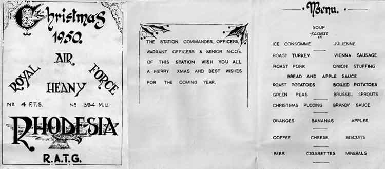
Christmas "Scoff-Card" - Christmas 1950.
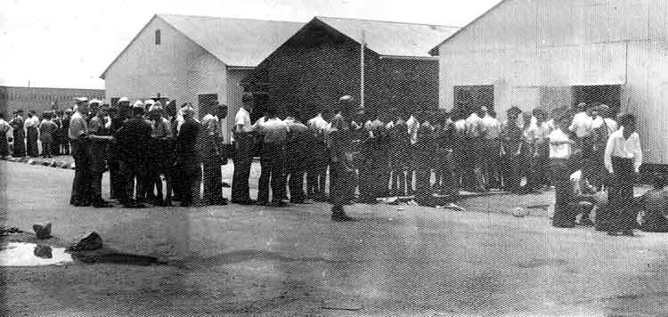
Queuing for Christmas Dinner - Christmas 1950.
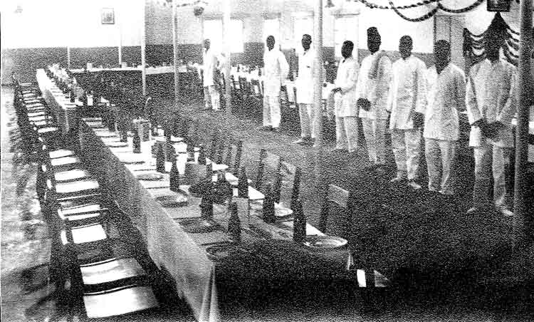
Waiting to Serve Christmas Scoff - Christmas 1950.
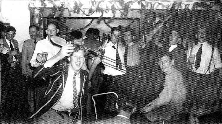
Another Session - Christmas 1950.
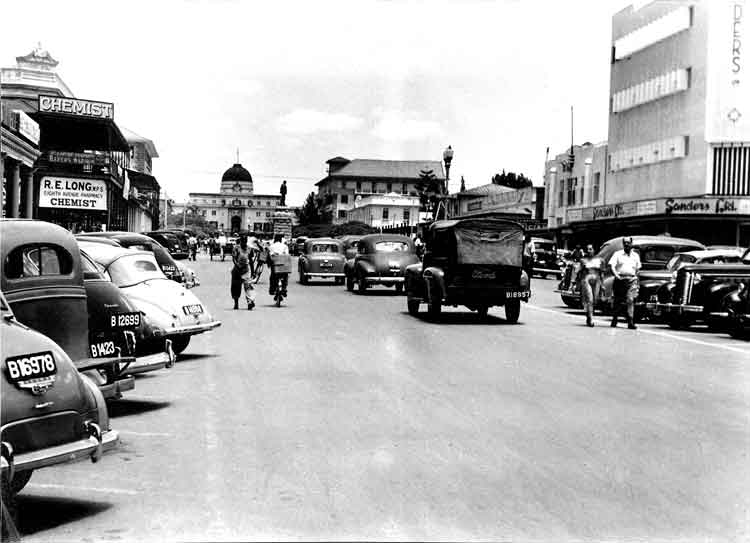
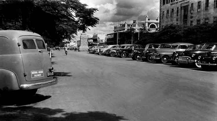
View of Bulawayo - January 1951.
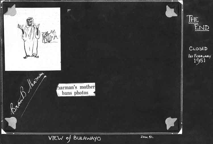
Under the last photo in the second album "View of Bulawayo - January 1951" was the following layout - I wonder what BeBe's Mum disapproved of!.
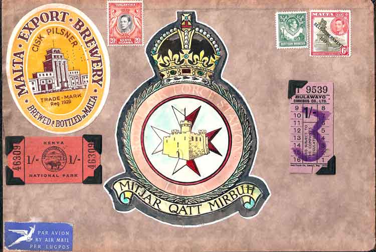
Back page of BeBe's second album with mementos of his time in Malta and Rhodesia.
(Thanks to Mamie Sharman and many quotations from Wikipedia.)
(
Click to go to Album 3.)